10/18/07: Day 9: Into the Valles Caldera
Waking in Grants, I had a glorious lack of dyspepsia. We had a slow breakfast in which I was able to eat a whole toasted dry English muffin with a glass of juice. Karen was eating almost with her normal vigor.
In light of our improving condition, Karen suggested going north along some mountain roads we hadn't yet seen.
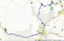
Trip from Grants to Los Alamos, NM. Note the left turn at Albuquerque. Note the very wiggly NM 4 at the top.
--Click to Enlarge--
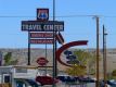
So, we took I-40 to the Route 66 Casino. Karen felt lucky, and I enjoyed the signs. I had little energy, and walked slowly around. I took pictures of some of the inventive signs.
Karen prepares to lose some loose change at the Route 66 Casino a half hour west of Albuquerque. Note the Federal Highway outline behind Karen.
--Click to Enlarge--

I appreciate signs designed to entice.
--Click to Enlarge--
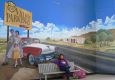
Karen poses at the Route 66 Casino valet area. This casino is a major theme player. Everywhere you look, there are artifacts or symbols of the heyday of this iconic thoroughfare.
--Click to Enlarge--
Then we finally made that fateful Bugs Bunny turn, we made a left at Albuquerque, heading up toward the winding Jemez Mountain Trail (a.k.a. Jemez National Scenic Byway).
Been there. Done That.Just passing through, again.
--Click to Enlarge--
It isn't marked as scenic on the AAA map, but is "considered by many as the state's most beautiful automobile route” according to a local visitors guide.
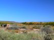
We were trying to get some miles in, but slowed for several scenic views. That is, slowed from the generally 45 mph that much of this road allows. We passed by Jemez Pueblo, we passed Giggling Springs, and stopped at the Walatowa Visitor's Center.
See the Sangre de Cristo mountains peeking whitely up past the far edge of the Valles Caldera in which I stand.
--Click to Enlarge--
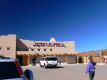
The visitors center by the Jemez (Hay-mes) pueblo.
--Click to Enlarge--
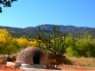
Another bread oven, called a Horno.
--Click to Enlarge--
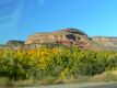
I took snapshots of a few spots along the road.
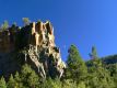
Pretty rocks from a speeding car
--Click to Enlarge--
Moon rising at Battleship Rock
--Click to Enlarge--
The Jemez territory, and Los Alamos sit in the Valles Caldera, the largest volcanic feature in the U.S.
Then on toward Los Alamos. This was the goal that got my attention this morning. I'd read accounts of the area from Feynman and Rhodes, and about more recent work done by Mark Tilden on robots there a few years ago. In case you forgot, Los Alamos was where Project Y of the Manhattan Engineering District was carried out, popularly mis-called "The Manhattan Project".
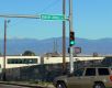
Where do you suppose they'd name a street after a remote nuclear test site?
--Click to Enlarge--
We first saw forbidding side roads off the picturesque highway with security gates, then had to pass through a security gate just to get into town. We got to the Bradbury Museum about a half hour before it closed. So we skimmed through exhibits, and then Karen decided to find a room while I perused the bookshelves of the gift store outside of the museum. Because we stayed in L.A, I spent more time there the next day. I'll tell and show you more then.