10/15/13: Day 13: Day 3 of the Blue Ridge from Meadows of Dan to Blowing Rock
Today was another tiring day of driving along scenic views. But it is the first day since Charlotte (Day 6) where it neither rained, misted, nor fogged. A dry day with more sun than overcast.
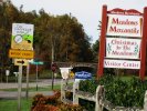
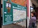
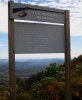
The Blue Ridge Motel on the Jeb Stuart Highway had coffee makers in the room, but no complimentary coffee. So to get started I got up and drove into town on the other side of the Blue Ridge parkway to get coffee from the Poor Farmer's Market (seen yesterday). Once Karen had her coffee, we could get back on the road. See the parkway in the middle of this picture of some of the Meadows of Dan signage.
--Click to Enlarge--
As we approached the bottom of Virginia, we realized the Mount Airy was not far from our course. This was the town on which Andy Griffith based the fictitious town of Mayberry. So we jumped off the Parkway and drove down the ridge on Fancy Gap Highway (US-52) to see what there was to see.
--Click to Enlarge--
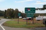
We entered North Carolina again on US-52, which is called Fancy Gap to the north, and Andy Griffith Expressway as we get into the more southern state.
--Click to Enlarge--
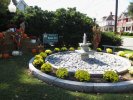
Mt. Airy, NC was a shock. Or more like a schlock. The entire town economy is based on fans of The Andy Griffith Show and its spin-offs. The guy at the Chamber of Commerce visitor's center said that we were in luck, the barber who actually cut Andy Griffith's hair was available for autographs.We decided to do a walking architecture tour, instead.
--Click to Enlarge--
But as the architecture of Mt. Airy was not much different from my own neighborhood, we didn't spend much time here.
--Click to Enlarge--
We have completed 292 of the 469 miles of the Blue Ridge Parkway after two and a half days of driving and stopping. Many, many pictures were taken. But between marginal connectivity and exhaustion, I did not select and process them until 11/22.
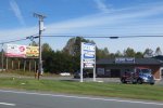
As we cruised out of there like 'danes from a con, I noticed this amusing sign. Clearly, these scenic winding roads build local businesses.
--Click to Enlarge--
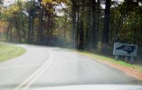
So we enter North Carolina for the third time on this trip, this time on the Blue Ridge Parkway. It is 12:31, and we really feel like we wasted the morning heading toward and extracting ourselves from a tourist trap.
--Click to Enlarge--
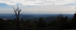
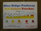
After half a dozen days of rain and fog, we finally have scenic views. The local color signs we've been seeing now have visuals to go along with them.
--Click to Enlarge--
A vista. That scar on the left is Stone Mountain.
--Click to Enlarge--
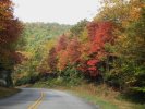
And we are also starting to see some real autumn color.
--Click to Enlarge--
There are so many places to stop and admire, that we sometimes just atop and glance, and move on to the next.
--Click to Enlarge--
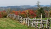
Other stops I walk around and line up shots that most others may not notice. A rustic fence between hay fields and the burning forest colors sooth me.
--Click to Enlarge--
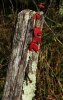
Post.
--Click to Enlarge--
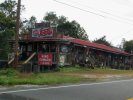
We stopped at the Northwest Trading Post because they had a series of fluttering "OPEN" flags along the road, to distinguish themselves from all the closed Park Service facilities.This was a reassuring notice, that the best color and highest peaks were yet ahead.
--Click to Enlarge--
I'd never wondered about this song that I'd learned as a child. But here we are where the action happened, and the fall guy left a legacy of song. Tom Dooley lives on generations after he was executed.
--Click to Enlarge--
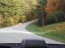
Because of the Government closures, we did not have much warning about closed sections of the parkway. We hit only one annoying one. Then our dueling map perceptions led us on a wrong way, and then a short cut on a small road that took us back to the parkway for the shortest loss of Blue Ridge miles.
--Click to Enlarge--
We decided to spend the night at Blowing Rock. We took the exit for the town rather than the feature, so by the time we parked, walked around, found info, and decided what to do, the state park was closed. This is a good town for those to whom travel means trendy shopping. For us, we just needed a place to collapse.
--Click to Enlarge--
But today we can finally see into the distance from overlooks. And the trees are at peak color, for a sub-standard color year.
Last night we stayed in an old fashioned Motel with good beds but little else to recommend it.
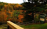
Tonight, for about 50% more (just over $100 with tax) we have a nicely upgraded old roadside motel just off the Parkway near Blowing Rock, NC.
Looking down from the parking lot of the Alpen Acres Motel across from the row of rooms: The sign for our motel near Blowing Rock, NC where it stands high above US-321 just off of the Blue Ridge Parkway. The trees across the highway are near peak color.
--Click to Enlarge--
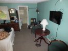
The motel rooms at Alpen Acres were nice.
--Click to Enlarge--
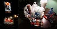
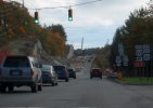
Karen spent quite a while with the woman at the front desk trying to find out where to eat. In our exhaustion, we finally decided to head away from Blowing Rock toward Boone, NC where the locals ate and shopped.However, the supposedly marvelous burger joint was way to loud for my jangled nerves.And the steak house was priced for the fly-in-to-ski set ($40 for a small steak, salad extra).So we ended up getting a roasted chicken and some extras at Food Lion. That chicken lasted us for several days of picnics.
--Click to Enlarge--