09/24/01: Monday 9/24/01: Scenic, but camera ran out of memory!
Some notes I've been keeping in my head: Sulphur. Brimstone. Yellowstone. Yes, I finally get it. Since my childhood, I'd never questioned the semantic root of the name of the park. Now, with the smell of sulphur in the air, in my hair, everywhere, and seeing some visibly yellowed stony areas, I get it.
Big Vehicles, Big Lenses. In Yellowstone, both my car and camera are distinctly undersized. Well, the car doesn't bother me, since it gets good mileage, even if it doesn't sleep six. As for the camera, the snap-shotters have similar size units, but I rather identify with those who spend some time framing, adjusting for light, and considering what can be done in post-production. Those guys (and gals) are hauling heavy glass. Some even have plate cameras. When we saw the moose, I took a snapshot of one such.
FossilsI'd always wondered why there were alternating strata of dark, eroded shale, and shiny white limestone in many places. In Yellowstone, I could see limestone deposits forming over soil (which will pack and crystallize into shale). I could watch plants (and imagine animals) getting encased in the sulphur and lime, which will fossilize the cellular structure, allowing only interesting minerals to displace the cells.
This is the only picture I took this day, because I had run out of room on my memory chip!
--Click to Enlarge--
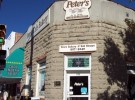
So, today we walked over to Peter's Bakery and Cafe for cappuccino, pastries, and bacon and eggs. As we were about done, an older couple from Maryland came in. How do I know? Karen started chatting with them. We spent about 45 minutes chatting, and touring their Victorian suite across the street in the Irma. The Buffalo Bill room. The Irma was built for William Cody and named for one of his daughters when he was the big wheel in town. The cherry wood bar was a gift from Queen Victoria. Besides his renown for the bison carnage, Cody was a partner in the project to dam the Shoshone river for irrigation purposes.
Anyway, after breakfast, we drove back toward Yellowstone to the Wal-Mart. I've somehow used up my 250 or so "low resolution" shots, and am hard pressed to find any that I can get rid of before seeing them at full resolution. Since I've had a full vacation worth in the Black Hills, and another in Yellowstone, I figured, what else could I need to shoot? Well, people convinced me that I'd find pictures to take in the Rockies. I bought a too expensive and too small SmartMedia card for my camera (all that was available in Cody, WY on short notice).
We drove again to the Buffalo Bill dam, because a (misinformed) cashier told Karen that the overlook and visitor's center were again open. This is the replacement, hydroelectric dam, for the original Shoshone Dam built by B.B. But the tunnels through the banded rock and the views of Shoshone Canyon were a nice and short drive in the wrong direction.
Finally, away from Yellowstone, and back to Thermopolis. Another hot soak, and a picnic lunch while looking over maps. We decided that we'd have to leave the Grand Tetons for another trip, so we could pass through Rawlins, where we'd been told there was an interesting jade mine.
After lunch we drove down the Wind River Canyon. I'd picked up a useful guide at the Themop Chamber of Commerce named "What Kinda Rock Izzat" (sic). The roadside signs told the geological era of the strata along which you were driving. From the relatively modern 150 million year old dinosaur level, down through single celled and beyond. It's quite a canyon.
We weren't ready to stop at the nice and scenic campground just south of the canyon. So we pushed on. We crossed the divide a couple of more times, crossing the Red Desert in the Great Divide Basin. This high depression has a few springs, but never enough water to flow anywhere, so it is completely surrounded by the Continental Divide. (In case you didn't know, the Divide is determined and defined by whether a stream in a given location would be Atlantic-bound or Pacific.)
Antelope became more common. We still didn't stop in Riverton. Rather than take the long way and stop in Lander, we took WY 135 south, and then 287 east all the way to Rawlins. Rawlins looked expensive in the AAA book. We figured that there must be something cheaper. The sun was brutally horizontal as we stopped at several motels. We finally stayed at the one I'd wanted to check out first, the Key Motel. Rawlins is a decaying industrial/agricultural center. It feels like a bad neighborhood, compared to the rest of Colorado.
This hotel seemed nice enough. The drunken yahoos who were partying around back, and in the halls till midnight, hurling Oedipal epithets like empty beer cans at whatever moved were a bit annoying. The phone had a modem port, but the heater didn't work. And, unrelated, I discovered that my 7 year old, tiny, plastic shampoo bottle top had cracked, probably from the pressure changes. I had to empty and wash out my bathroom kit.