10/03/11: Day 4: Alliance, NE to Casper, WY
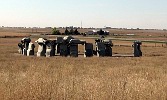
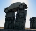
I thought to Google the town we happened to stop in last night, Alliance, NE, and found that there in a roadside attraction. Carhenge. So our first stop out was Carhenge. More details via the pictures.
A snapshot of Carhenge \(http://www.carhenge.com/\) near Alliance, NE. This picture is actually the right eye view of a stereo pair. Eventually I hope to post the 3-D versions of the pix from Carhenge.
--Click to Enlarge--
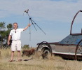
So Karen took some pictures of Carhenge \(http://www.carhenge.com/\) with my super-zoom camera while (in this case) I brandished my home made stereo camera.
--Click to Enlarge--
Karen taking a picture of a leaping salmon sculpture with Carhenge behind her.
--Click to Enlarge--
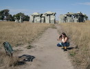
I had to show at least one shot from inside the henge.
--Click to Enlarge--
I appreciate the covered wagon state road signs along this former wagon trail
--Click to Enlarge--

Then we took smaller and smaller roads over to the Agate Fossil Beds.
The smallest road was on the map, but an unmarked turn-off from NE-71 with no hint about its name or endpoint. But I found it after doubling back to where I thought the map said there was a road. We cruised over six miles of the rolling western sandhills (paved at best with sand and gravel) at up to 55 mph to avoid a 60 mile detour on paved roads. Sure, I slowed approaching the crests of dunes, and a few times felt the car sliding sideways. It was fun.
We headed west from Alliance with the goal of seeing the Agate Fossil Beds. This dirt road, rolling over the sand dunes of western Nebraska, is the unmarked-from-the-east "Cut A Cross" road between NE-71 and NE-29. I missed the unmarked turn and had to double back and take an obscure driveway. Then I cruised along the dunes (often drifting a bit) as we roller-coastered at up to 55 mph in our little sedan. This is actually a frame of a time lapse of the bumpy ride.
--Click to Enlarge--
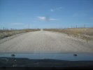
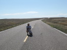
Once we emerged on NB-29 and headed north a ways, I saw something of which I wanted to stop and take a picture. Or perhaps I just wanted to unwind after that exciting dune ride.
--Click to Enlarge--
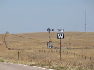
Here is a telephoto shot of the road sign and a (spinning) windmill and fence all shimmery in the unseasonable heat rising from the hot highway. Remember, this is October in north-western Nebraska.
--Click to Enlarge--
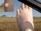
We discovered these burrs on that photo op stop. They really penetrate!
--Click to Enlarge--
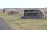
Finally, the entrance to the Agate Fossil Beds National Monument.
--Click to Enlarge--
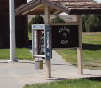
Speaking of fossils, an actual pay phone! I haven't seen a booth with a working phone in it in years. But out here cell signal is iffy at best.
--Click to Enlarge--
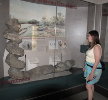
Karen in the Agate Fossil Beds \(http://www.nps.gov/agfo/index.htm\) interpretive center viewing fully excavated Daemonelix, the petrified spiral burrow of an extinct mammal.
--Click to Enlarge--
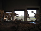
A snapshot of the assembled old mammals on display at the Agate Fossil Beds \(http://www.nps.gov/agfo/\) interpretive center. Camels, ground sloths, proto-beavers, and more. The short film about the site does a good job of explaining how we know about these guys, as well as what we know.
--Click to Enlarge--
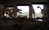
They have some nifty displays here. I'm glad we took this odd detour. Actually, it is more like an entour.
--Click to Enlarge--
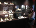
The Agate Fossil Beds center also houses the Cook Collection of settler and Indian artifacts. Karen relates to her distant relatives through these sorts of displays.
--Click to Enlarge--
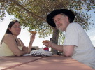
We had lunch in the parking lot on this hot October day, before taking the long hike to see the fossils in the wild.
--Click to Enlarge--
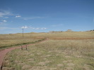
See those hills/mesas way over there? That's where the walking trail takes us. It is a steeper climb than it looks. But it was a beautiful day for it.
--Click to Enlarge--
Up among the actual fossil beds, Karen sees how many she can spot while we catch our breath and cool down in the shade. It is hard to believe that this is October near the junction of South Dakota and Wyoming.
--Click to Enlarge--
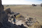
Here is one of the many daemonelixes (daemonelices?) easily found out here. This one is protected from tourists and other erosive forces.
--Click to Enlarge--

We spent 2 hours at and around the Agate Fossil Beds interpretive center, picnicking in the parking lot, and hiking among the Daemonhelices and other exposed old mammal evidences. Hiking up steep paths at 4,500 feet is not what my lungs are used to.
We stopped on the outskirts of Lusk, WY to try to read the sign for the antique redwood water tank that has filled steam engines and such for generations.
--Click to Enlarge--
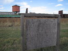
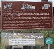
Here are some more readable signs near the water tank. Well, I thought they were interesting.
--Click to Enlarge--
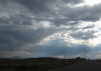
Then we just drove over toward Casper. Several towns along the way listed single and double digit populations. The Wyoming border was barely marked on US-20. But it was interesting to drive toward rainy mountains with periodic sun.
Much cathedral lighting.
I just like windmills. And dramatic skies
--Click to Enlarge--
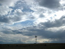
Catherdarl skies, a mountain, and a church on a hill. We're not in Kansas any more.
--Click to Enlarge--
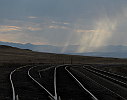
I stopped to snap a shot of a bend in the tracks and the interesting sky toward which we were heading.
--Click to Enlarge--
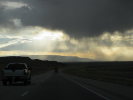
Oh, dear. That's rain we're driving toward. There in the valley.
--Click to Enlarge--
After the snafu at Douglas (read the Day 4 log entry \(http://www.danklarmann.com/2011OctTrip/trip.cgi?Date=10/03/2011\)) we made it safely into Caspar and spent the night at a theme motel.
--Click to Enlarge--
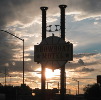
We'd planned to stay in Douglas, WY, but there was no room at any of the six inns we checked; hunting season has opened! So we took I-80 over to Casper and found a nice room in the National 9 Steamboat Inn for under $60. Room prices rise with elevation.
Here is the map of the day:
View Larger Map


