10/14/13: Day 12: More on the Blue Ridge
From Buena Vista and Lexington down to Meadows of Dan, VA, described in captions.
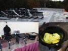
The old Howard Johnson up on a ridge just north of Lexington, VA had several features that amused me. I showed the view \(http://danklarmann.com/travels/?PicNum=201310131644\) before. But here we see solar water heaters on the roof, with the old restaurant spire behind them. The restaurant is but an empty bay in the building, now. But they had a nice lobby breakfast with dueling waffle irons, and egg pucks.
--Click to Enlarge--
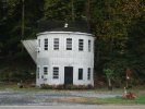
We had to take a snapshot of this Building Shaped Like a Coffee Pot \(http://www.roadsideamerica.com/story/6174\) on the road near Buena Vista.
--Click to Enlarge--
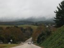
Ahaed is the Blue Ridge itself. Up there in the clouds. It does not look like a scenic day, but we are determined to drive the ridge, fog or no.
--Click to Enlarge--
Still climbing the roads up to the entrance, and I saw this off of a bridge and asked Karen to pull over. I walked back in the light mist, and took a few shots. I like reflections. Meanwhile...
--Click to Enlarge--

... Karen stayed int he car and looked over the map.
--Click to Enlarge--
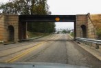
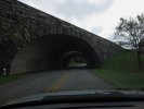
I enjoy any attempt by architects to make mundane features more interesting. Here is a railroad underpass that I liked the looks of.
--Click to Enlarge--
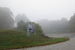
Finally, the Blue Ridge Parkway! You may note from the picture number that it is 9:03 (0803 CDT). The visibility is as bad as we suspected. But it lends a nicely sinister note to what we see here, and (next slide, please)
--Click to Enlarge--
Here are ghost trees. Or tree ghosts. These towers were vine wrapped trees. The trees died, and rotted away, but the sheath of vines are still standing.
--Click to Enlarge--
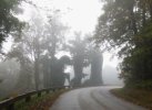
Looking up at these hollow cylinders of vine, you can see the light coming through where once there was a trunk.
--Click to Enlarge--

We stopped at Otter Lake in a valley that dropped below the cloud line to walk around. There is starting to be a bit of color in the trees.
--Click to Enlarge--
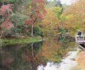
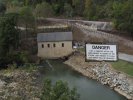
Another architectural note: You may have noticed how perfectly the reflection in the previous picture met its source in one area. Here you can see the almost perfect flat top to the dam. Such perfection would primarily be for the purpose of creating that effect.
--Click to Enlarge--

What's my sign? Well, someone left this here for me.
--Click to Enlarge--
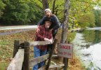
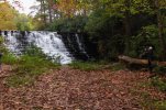
I snapped a shot of Karen taking a picture of the dam cascade.
--Click to Enlarge--
I stepped out of the car to show how hard it was to even see the warning signs for scenic wonders on this day.
--Click to Enlarge--

Ah, the grand vista of Arnold Valley. Perhaps on another trip.
--Click to Enlarge--
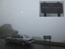
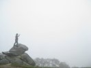
Dan on the rocks, high above Arnold Valley
--Click to Enlarge--
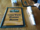
We stopped for an early lunch at Leaks of Otter Lodge. They petitioned the government for the right to open even though all facilities are supposed to be closed on the grounds that there were no actual government workers present, nor were the grounds government maintained. So here they are, one of the few things open on the entire Blue Ridge.I'm guessing that is why the small woman with the big camera and her staff were interviewing the staff.
--Click to Enlarge--

A comprehensive theme of wood.
--Click to Enlarge--
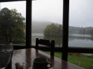
The view from our table of Abbott Lake
--Click to Enlarge--
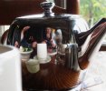
Always the one to take advantage of shiny things: Dan and Karen at lunch.
--Click to Enlarge--
We don't often eat at places with wooden napkin rings. But when we do, I show it.
--Click to Enlarge--

The clouds trying to come down to Abbott Lake
--Click to Enlarge--
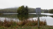
After another hour of fog driving, we dropped below the clouds, and rested at Mills Gap for me to fail to get another time lapse sequence.
--Click to Enlarge--
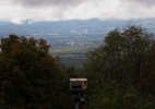
Meanwhile, the way that the paint on the road protects it fascinated me. The lines clearly have seen better days. But the road around them has eroded many millimeters deeper. These moist conditions do eat the roads.
--Click to Enlarge--

During this break, Karen does some stretching.
--Click to Enlarge--
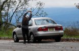
A little later, at another stop to savor (and time lapse) Dan takes the board walk in the futile search for some signal.
--Click to Enlarge--

Dramatic clouds.
--Click to Enlarge--
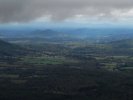
The dramatic diagonal underpass below US-221/460
--Click to Enlarge--
Looking down from a long, high bridge over the Roanoke River Gorge.
--Click to Enlarge--
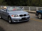
Spotted on the span above the Roanoke River Gorge, note the relative attentiveness of the front and rear seated passengers in the beamer.
--Click to Enlarge--
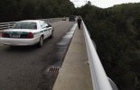
Karen, a cop, and a tricycle on the bridge across the Roanoke River Gorge.
--Click to Enlarge--
Down the trail to the bottom of the Roanoke River Gorge.
--Click to Enlarge--

The sign said: Extreme danger, do not climb on or over the wall. I stood on the wall to take this shot. It's only a fifty foot drop to the rocks on the edge of the Roanoke River a few inches behind Karen.
--Click to Enlarge--
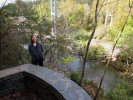
One thing I noticed up on the Blue Ridge is that so many bridges and tunnels curve. For tunnels, this only makes it hard to see how long it is. But bridges do ice over. And things only travel in straight lines on an icy bridge. THis is why the parkway is closed so much during the freezing season.
--Click to Enlarge--
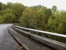
I stay up on the boardwalk just in case a scenery-distracted driver comes around the curve. Bicyclists don't really have that option. Danger.
--Click to Enlarge--
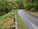
The fog rises late in the day, and we get to see a scenic valley. I misnumbered the picture, this is 14:47 CDT or a quarter to four up here.
--Click to Enlarge--

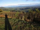
I take quite a few pictures of my shadow; sort of to prove that I was there. I have a collection of these called "A Void in the Landscape \(https://www.facebook.com/media/set/?set=a.3290928567140.108006.1685526085&type=1&l=b58f6e5860\)".
--Click to Enlarge--
We finally get the the most photographed point on the Blue Ridge Parkway, Mabry Mill.
--Click to Enlarge--

I try to find views of the Mabry Mill that other shutterbugs are skipping.
--Click to Enlarge--
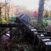
I saw this across the grounds, and could not figure out what it was. I had to read the sign and learn something!
--Click to Enlarge--

Although all the buildings were closed (along with the government) I found cracks through which I could point my small bu able camera to see the inside of (in this case) the sawmill.
--Click to Enlarge--
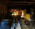
Dan and Karen shadows at the Appalachian House
--Click to Enlarge--

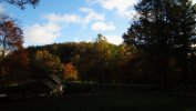
Another nice shot of the Mabry Mill.
--Click to Enlarge--
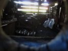
Peering into the smithy through a knot hole.
--Click to Enlarge--
Some of the gaggle of photographers.
--Click to Enlarge--
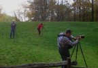
Just south of Mabry Mill is Meadows of Dan. This seemed an appropriate place to stop for the night. This old roadside motel is the lodging option in town.
--Click to Enlarge--

A quick stop for fruit and cheese for dinner.
--Click to Enlarge--
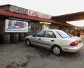
Misquoting Garrison Keillor
--Click to Enlarge--

Back to our room, behind and above the main building that once had a restaurant as well as the lobby and managers housing.
--Click to Enlarge--
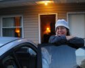
Me almost in our room in Meadows of Dan, VA
--Click to Enlarge--
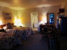
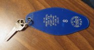
You know you are in an old motel when, not only does the room have a metal key, and not only does the key have the room number attached, but the fob has the address of the motel to assist the old tradition of dropping a mistakenly taken key in a mailbox to return it. Also note: We are at the intersection of the Jeb Stuart highway. If you didn't know, J.E.B. Stuart \(http://en.wikipedia.org/wiki/J.E.B._Stuart\) was the first man ever named "Jeb," and a famous Confederate general.
--Click to Enlarge--
