11/11/22: Day 8: Short Drive with Long Scenic Detours
From Moab to Monticello, over every kind of road: Paved, narrow paved, gravel, and rutted dirt. Scenic views, though.
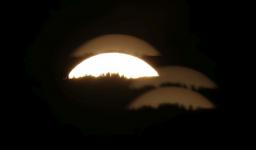
Took pix of the moon rising last night, and this morning I see the moon before it sets from our motel in Moab.
--Click to Enlarge--
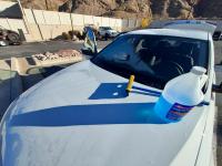
Another frosty morning wherein I test that the washer solution melts the ice from the window.
--Click to Enlarge--
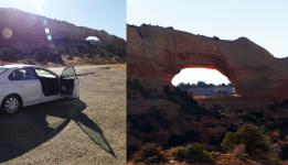
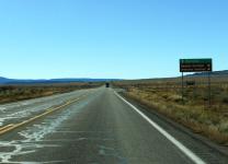
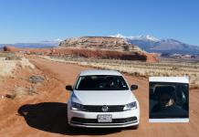
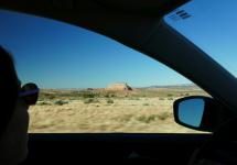
We pulled over on our way south to glance at a natural bridge. Wilson Arch, I looked it up later.
--Click to Enlarge--
Summary of Day 8: Went to Needles Overlook, and to Anticline Overlook, and then ended in Monticello.An exhausting and scenic side trip.
--Click to Enlarge--
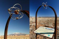
At the entrance to the road to those overlooks stands a memorial of steel and stone dedicated to the uranium miners from the Lisbon Valley.
--Click to Enlarge--
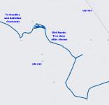
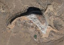
We were heading up well paved and just wide enough for two cars CR-133, when Google offered a side road for only six minutes longer to our destination. I was feeling adventurous. This picture shows the GPS history of that little loop.No cell signal, and clearly GPS was touch and go for a while.
--Click to Enlarge--
We seem to be heading for that monolith up ahead.
--Click to Enlarge--
Now Google tells us to turn around the triangle. Um, okay. It looks like private property. I get out to take pictures, and Karen loops around the grass triangle.
--Click to Enlarge--
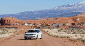
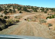
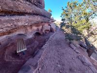
Modern cliff dwellers! The fronts are modern buildings, but they clearly are built under the overhanging rock, and into the cliff itself.
--Click to Enlarge--
Karen smiles for the camera, and I get back in the car. Google tells us to take a right, and a right.
--Click to Enlarge--
I later looked up what this hidden community of Cliff Dwellers was about. The Rockland Ranch. Pretty much invisible unless we took this particular dirt road.
--Click to Enlarge--
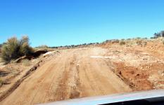
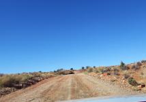
The road out is getting a bit rough, compared to the road in. Ruts, rocks, and wash-outs.
--Click to Enlarge--
As the going gets tough, Karen says, You get driving.
--Click to Enlarge--
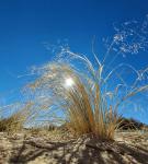
Before I get in the car, I take a shot of the grasses.
--Click to Enlarge--
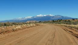
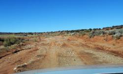
Steeper hills and deeper ruts. I worry about beaching our little city sedan on this road clearly rated for 4WD.
--Click to Enlarge--
Finally we see "Shortcut Rd 2" that appears to head directy back to pavement. This is better.
--Click to Enlarge--
Karen grips the dash board as I drive, so I have to snap the occasional picture. I just point and shoot, without looking at the camera.
--Click to Enlarge--
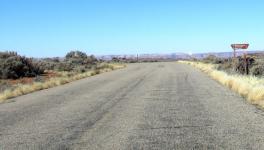
Ah! Pavement! Back toward the Needles Overlook. The promised 6 minute detour took about half an hour.
--Click to Enlarge--
Dan takes pictures from the Colorado River sign.
--Click to Enlarge--
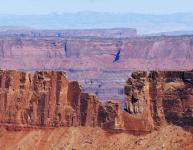
How big does a hole in the rock have to be to call it an arch?
--Click to Enlarge--
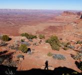
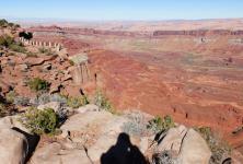
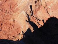
Dan does a shadow selfie on the canyon rim.
--Click to Enlarge--
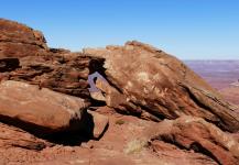
On our previous trip in 2017, I was barely able to walk around, two years after having mono. This trip, I can hike and climb, but Karen has foot issues. So while Karen prefers to stay on paved surfaces, I wander around the rougher trails and discover little places to shelter from the storm.
--Click to Enlarge--
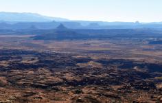
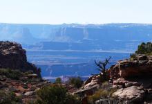
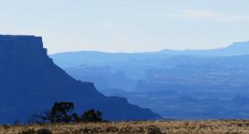
Layers across Canyonlands.
--Click to Enlarge--
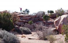
Karen spots me from an overlook.
--Click to Enlarge--
Overlooking the Needles Overlook.
--Click to Enlarge--
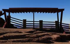
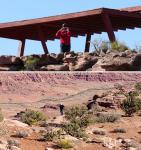
I appreciate the architecture of the railings and shelters of the overlook.
--Click to Enlarge--
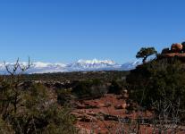
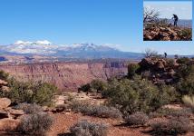
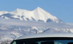
Things are greener on the side toward the white mountains.
--Click to Enlarge--
The view from Six Shooter Overlook, shooting into the sun.
--Click to Enlarge--
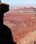
The dark side of a "needle" far below, lit by the red cliffs over which I look.
--Click to Enlarge--
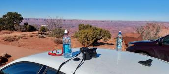
Just evokes a car trip, in my eye.
--Click to Enlarge--
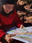
We review the map before moving on to Anticline
--Click to Enlarge--
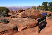
Needless picture of Needles sign. But proof we made it up there.
--Click to Enlarge--
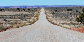
Only 18 miles round trip from the junction to Anticline Overlook. All washboarded gravel. The car kept wanting to dive left and right; driving was a matter of outsmarting the road the entire time.
--Click to Enlarge--
We took a minor side road to Minor Overlook.Same gravel, though. Not like the earlier trail of fear.
--Click to Enlarge--
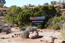
Sign at Anticline
--Click to Enlarge--
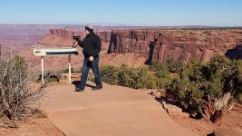
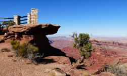
Karen took a picture of Dan as he climbed up to the cliff edge at the Anticline Overlook.
--Click to Enlarge--
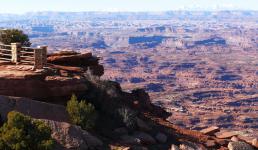
Dan's view of the overlook.
--Click to Enlarge--
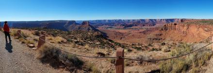
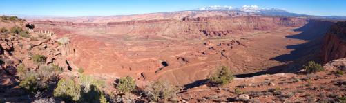
Panorama from above the overlook.
--Click to Enlarge--
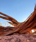
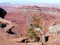
I like wood.
--Click to Enlarge--
So many views to choose. Near and far.
--Click to Enlarge--
We like-a the red rocks.
--Click to Enlarge--
Karen shot me down there, so I shot her up there
--Click to Enlarge--
The reason for the name Anticline: After the sediment layered into stone, the stone got folded. Here, the layers are sideways. You can see these leaves of rock standing on end, right up against rocks that are not so inclined.
--Click to Enlarge--
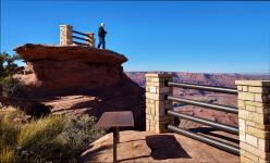
I don't overlook the architecture of overlooks, either.
--Click to Enlarge--
Karen took a picture of Dan walking out beyond the railing, on the cantilevered part of the overlook. But it is hard to tell from this angle.
--Click to Enlarge--
Just so many different views up here.
--Click to Enlarge--
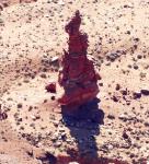
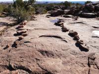
The trails up here are marked with rocks.
--Click to Enlarge--
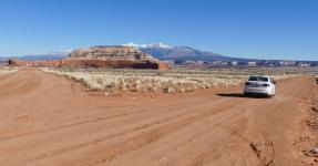
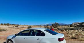
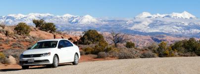
Our car likes the mountains. Karen asked me to show our happy car.
--Click to Enlarge--
Always remember where I set my glasses when I take them off to peer through the viewfinder of my camera.
--Click to Enlarge--
A view from an overlook on our way back down the long gravel road.
--Click to Enlarge--
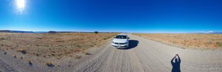
A panorama from the red rock canyon toward the sun to the white mountains on the other side. With Karen waiting for me in the car on the long gravel road.
--Click to Enlarge--
Back down to the paved road, and heading back to the highway, it seems that you can see the cliff dwellers, if you know what to look for.
--Click to Enlarge--
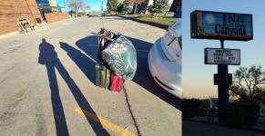
Arrived at the Inn at the Canyons
--Click to Enlarge--
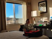
We settle into our room and have a snack. I like being able to lie on my bed and watch the windmills.
--Click to Enlarge--
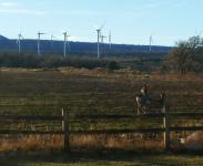
Looking out of our window, we see antelope grazing just across the parking lot, unconcerned about the megawatts being farmed in the next field.
--Click to Enlarge--
I take a picture of the sun settling behind the hills, through the multi-layer window of our room.
--Click to Enlarge--
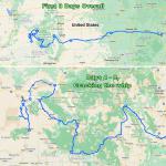
Map thru Day 8, showing the full trip, and zooming in on the last few days through Arches to Monticello
--Click to Enlarge--
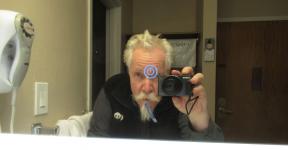
Last shot of the day: Selfie in a touch activated heated mirror, while brushing my teeth. What a weird world,
--Click to Enlarge--