11/12/22: Day 9: Monticello to Blanding, sites and thoughts
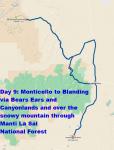
Today we did another nominally short drive from Monticello to Blanding, UT. But the 54 miles (direct route) was actually a 110 mile detour, up to the main road into Bears Ears and southern Canyonlands, and then back out over the mountain via Harts Draw Road.
Lotsa words in the captions.
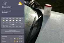
A chilly morning dawns in Monticello. We had put the ice jar from the cooler atop the hood of the car to refreeze overnight. 18° when we got up.
--Click to Enlarge--
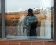
Karen opens the curtains to see me out in the parking lot. With windmill turbines and mountains in Monticello, UT.
--Click to Enlarge--
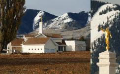
The local church, Mormon Temple, is on the property just south of the hotel.
--Click to Enlarge--
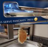
There was a busload of traveling teen sportsers in the breakfast room, but no waffle iron. However, there was an automatic pancake maker! Never saw one before. I took a video. Here are a couple of grabs near the beginning and end.
--Click to Enlarge--
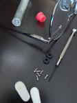
One advantage of car travel is that we can pack for most contingencies. Lost a screw from my glasses, and we had a glasses repair kit in the glove box (bought on a previous trip at the Little America truck stop).
--Click to Enlarge--
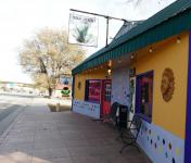
Across the highway from Canyon Inn is the High Desert Cafe. A nice capuccino house, for some "real" coffee
--Click to Enlarge--
Gas prices are up. As the pandemic winds down, demand shot up (as people eagerly are getting out), and production is lagging (because of low wages and petroleum companies enjoying the windfall.) It puzzles me that the media pundits call it "inflation." Wages are stagnant; inflation is when wages increase as do prices.So high altitude 85 octane gas is $4.599/gallon here along the middle of a small highway.
--Click to Enlarge--

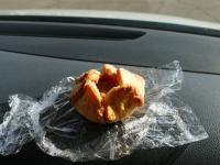
Warming a pastry from the High Desert Cafe on the dash.
--Click to Enlarge--
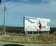
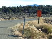
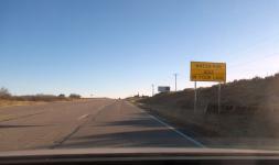
Sign of the times: People coveting better internet, and the opioid crisis.
--Click to Enlarge--
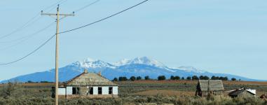
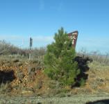
Architecture imitating nature. Or a commentary on the demise of small farmsteads.
--Click to Enlarge--
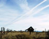
The railoroad tracks in the sky passing over the ruins of an American Dream.
--Click to Enlarge--
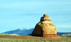
It's a rock. Note the cave in the bottom.
--Click to Enlarge--
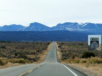
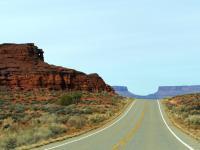
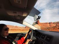
The road ahead. Toward Bears Ears and Newspaper Rock.
--Click to Enlarge--
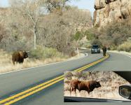
Bovine road hazards in Bears Ears National Monument.
--Click to Enlarge--
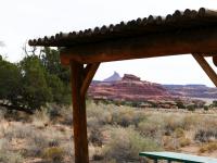
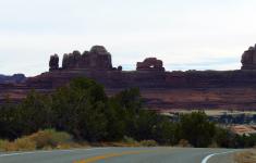
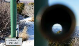
Six Shooter Rock and others that we saw from above, yesterday.
--Click to Enlarge--
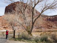
We did occasionally stop by the Colorado River and walk and breathe.
--Click to Enlarge--
Karen used binoculars to look for critters. I use my more powerful monocular zoom camera.
--Click to Enlarge--
Textures
--Click to Enlarge--
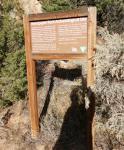
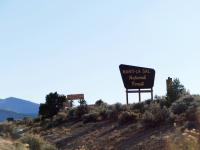
At the Visitor Center for the southern entrance to Canyonlands National Park (the less popular route). You'd need 4WD in good weather to get to the other entrance from here. It's like two different parks.
--Click to Enlarge--
At the southern Canyonlands Visitor Center, there is a garden exhibit. Not much happening in November. But Karen found:"Winterfat Krascheninnikovia Janata Amaranth family (Amaranthaceae) In autumn, winterfat's flowers develop into striking, woolly white seedheads. Cattle favor its foliage enough that in overgrazed areas, the shrub disappears. Mule deer, desert bighorn, jackrabbits, desert cottontails, kangaroo rats, and pocket mice eat its leaves or seeds."
--Click to Enlarge--

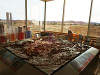
Canyonlands Visitor Center has a map of the park, aligned with the park, and by the windows so rangers can point.
--Click to Enlarge--
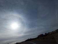
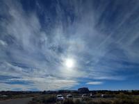
As we drive into lower Canyonlands, I glance up at the sun to see a sunbow, and a contrail neatly bisecting the target. This was my best shot, without having to ask Karen to stop the car.
--Click to Enlarge--
♪ Let's Go Ridin' in the car car ♫
--Click to Enlarge--
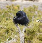
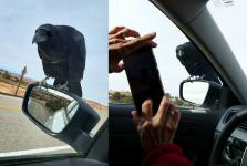
Caw. As I said, Karen has binoculars; I have a long lens.
--Click to Enlarge--
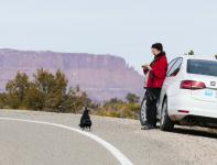
Karen took a picture of me birdwatching.
--Click to Enlarge--
Would one call this crow couple "Attempted Murder?" Karen appears unconcerned.
--Click to Enlarge--
Crows getting presumptuous. Karen properly uses portrait mode.
--Click to Enlarge--
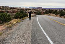
End of the road at this end of Canyonlands. Big Spring Overlook Trailhead.
--Click to Enlarge--
Dan is not particularly scared of heights.
--Click to Enlarge--
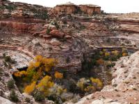
A little box canyon with autumn foliage
--Click to Enlarge--
Thinking of architecture. That 25mph sign is not so important in daylight. But for night, note how the sign is basically in the middle of the lane for those heading down this slope in the dark. It meta-tells a driver that the road is curving left, before the forewarned right,
--Click to Enlarge--
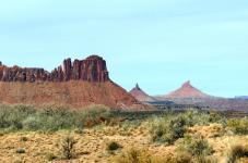
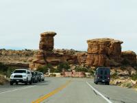
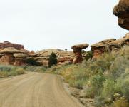
We like getting off of the main roads, and seeing some of the littler sights, like these pillars and balancing rocks.
--Click to Enlarge--
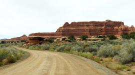
Banded rocks and dirt roads
--Click to Enlarge--
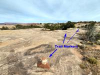
Trail markers on the Roadside Ruin trail are stacks of rocks
--Click to Enlarge--
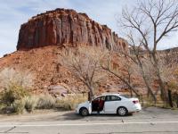
Lunch break at Roadside Ruin Trail parking area.
--Click to Enlarge--
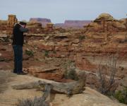
The hazy skies do not provide good light for showing off the banded rocks, but they are interesting in and of themselves.
--Click to Enlarge--
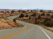
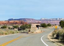
Leaving Canyonlands, to cross Bears Ears again.
--Click to Enlarge--
The sun got through the clouds, lighting up the rocks.
--Click to Enlarge--
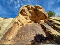
Newspaper Rock Archaeological Site is a petroglyph panel etched in sandstone that records approximately 2,000 years of early human activity. Pre-historic peoples, probably from the Archaic, Basketmaker, Fremont, and Pueblo cultures, etched on the rock from B.C. time to A.D. 1300. In historic times, Ute and Navajo people, as well as European Americans made their contributions. In interpreting the figures on the rock, scholars are undecided as to their meaning or have yet to decipher them. In Navajo, the rock is called "Tse' Hone" (Rock that tells a story). Unfortunately, we do not know if the figures represent storytelling, doodling, hunting magic, clan symbols, ancient graffiti or something else. Without a true understanding of the petroglyphs, much is left for individual interpretation. Newspaper Rock is listed in the National Register of Historic Places. Please continue to preserve it.
--Click to Enlarge--
The protective overhang of Newspaper Rock in Bears Ears National Monument. Feels blunty Damoclean. As in a boulder of Damocles.
--Click to Enlarge--
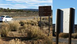
On advice of a ranger, we left UT-211 (we'd seen it) to take Harts Draw Road over the mountain, and more directly (on the map) to where we are heading.She said that the forest service access road was just fine; she uses it all the time. Are these low caliber target practice, or buckshot?
--Click to Enlarge--
End of snow removal, travel at your own risk. Foreshadowing?
--Click to Enlarge--
Harts Draw Road crosses Manti-La Sal National Forest
--Click to Enlarge--
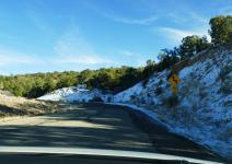
Signs of snow ahead, as we climb. Karen learned to drive in So-Cal, so I am the snow driver. Especially when the dry weather speed limit is already down to 15mph.
--Click to Enlarge--
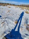
We are mos def climbing as the sun gets lower. Shadow selfie.
--Click to Enlarge--
Only 10 more miles to Monticello, where we spent last night.
--Click to Enlarge--
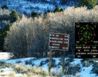
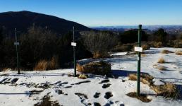
Up at the pass, there are site sights. Tubes to help tourists find the various named features, at kid and adult height.
--Click to Enlarge--
Scenic overlook with scene finders.
--Click to Enlarge--
Late afternoon snow selfie, with mountain.
--Click to Enlarge--
The east side of the mountain was my turn to drive. Yee, I say, haw.
--Click to Enlarge--
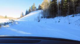
Driving on snow up on Harts Draw Road
--Click to Enlarge--
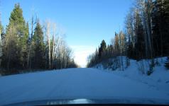
As we got lower, the snow turned to ice pack. But not bad driving, as there was no oncoming traffic.
--Click to Enlarge--
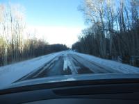
And on down the hill to Monticello. Our origin today, but not our destination.
--Click to Enlarge--
One of the wind turbines, and a well placed sign: Leaving Manti-Lasal National Forest. Wait, the entry sign clearly said "Manti-La Sal". Did we cross into a parallel place?
--Click to Enlarge--
As we get back on US-191 and head south from Monticello, we watch for deer in our lane
--Click to Enlarge--
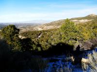
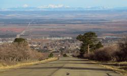
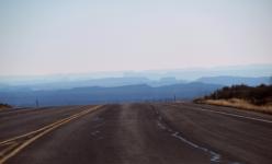
Layers of mountains heading south
--Click to Enlarge--
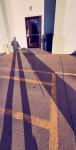
Shadow selfie hauling our luggage from our car (parked outside our room window) to the upper entrance of the split-level motel, Arch Canyon Inn in Blanding UT.
--Click to Enlarge--
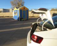
As I unload the car, I hear a couple of teenage girls giggling away in the local burger and shake dispensary here in the motel parking lot (right by the highway/Main Street.)
--Click to Enlarge--
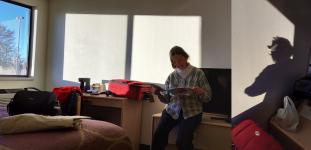
Karen studies the local dining guide, and I take another selfie.
--Click to Enlarge--
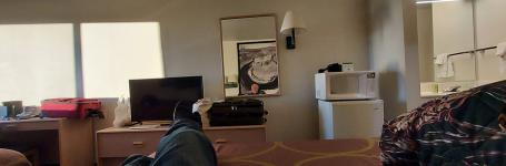
We never turn on the TV when we travel. I'm resting up to go out to eat, and this shot shows my face in the mirror, against the B&W motel art of Dead Horse Canyon. There are several monochrome views of surrounding features in the room.
--Click to Enlarge--
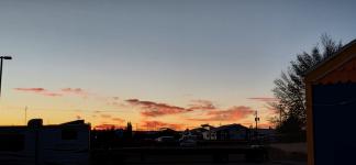
The sun sets past the shake shack, as we head out for an evening repast.
--Click to Enlarge--
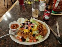
We dine at the Homestead Steak House off the main drag, that serves chili on fry bread, and micro brews of odd extraction.
--Click to Enlarge--
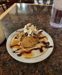
And fried ice cream for dessert at the Homestead Steak House.
--Click to Enlarge--
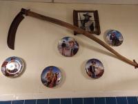
Karen wanted to capture part of the John Wayne wall at Homestead Steak House, because of her dad's fondness for the actor.
--Click to Enlarge--
Our route for Day 9, Nov 12, was from Monticello to Blanding, UT
--Click to Enlarge--