11/13/22: Day 10: Blanding to Hanksville, with Natural Bridges
Day 10 was a short-ish drive of about 2 1/2 hours. But with some serious hiking in the middle. Captions tell teh story.
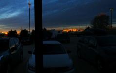
Sunrise from our motel room in Arch Canyon Inn, Blanding, UT
--Click to Enlarge--
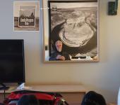
Selfie as I sit digesting breakfast, facing a mirror from my bed. The Dead Horse Canyon picture behind me has an Arch Canyon Inn sticker on it.
--Click to Enlarge--
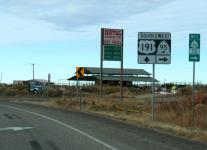
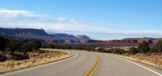
Shortly after starting out, we leave U.S. highway 191 south for Beehive Ninety-five west.
--Click to Enlarge--
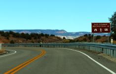
When the sign saus, turn right, and the road dives left.
--Click to Enlarge--
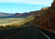
The road was cut into the cliff for a gentle descent, before we turn left and across the bottoms ahead.
--Click to Enlarge--
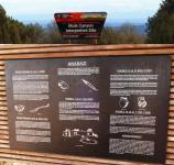
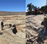
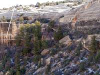
We stop at the Mule Canyon Interpretive Site, for a glimpse of living here a thousand years ago. Back before whatever pandemic depopulated the Americas mere generations before Europeans arrived.
--Click to Enlarge--
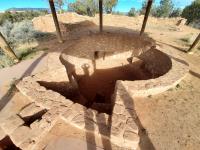
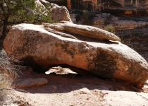
Climate controlled apartment from Roman times, but in the so called new world.
--Click to Enlarge--
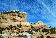
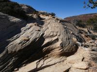
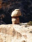
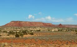
Just some of the pretty rocks along the drive
--Click to Enlarge--
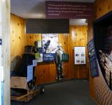
Naturla Bridges National Park Visitor's Center has a Dobsonian telescope, for all these dark nights. But we'll have moved on before nightfall.
--Click to Enlarge--
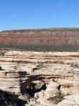
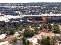
The first bridge we see in teh park is a bit undewhelming, after all the scenery along the drive. Moon for scale?
--Click to Enlarge--
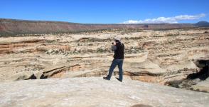
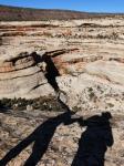
Karen took a picture of me taking that picture. She doesn't like to get so close to the edge.
--Click to Enlarge--
Paths are marked with loose rocks, rather than solid railings. Darwinian?
--Click to Enlarge--
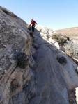
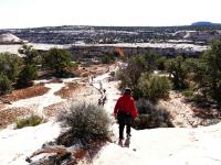
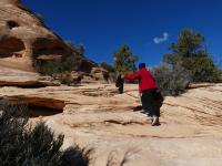
Karen following me down one of the trails. I still move like a goat. But her feet are not as adept. On our previous trip five years before, she always had to wait for me (chronic EBV fatigue). This time, I get to bound ahead.
--Click to Enlarge--
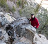
A turnabout picture. Karen says she can see just fine from there.
--Click to Enlarge--
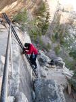
Some arches are accessible via bouncy wrought iron stairs.
--Click to Enlarge--
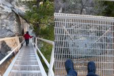
And some stairs lead to ladders.
--Click to Enlarge--
Happily heading on down. Still looking down at treetops.
--Click to Enlarge--
Karen poses under a slight overhang as I take a panoramaof the view
--Click to Enlarge--
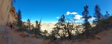
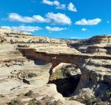
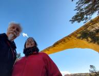
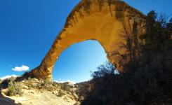
There's the arch proised at the trailhead. There are pockets of snow everywhere there is shade.
--Click to Enlarge--
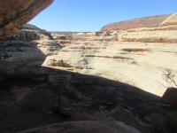
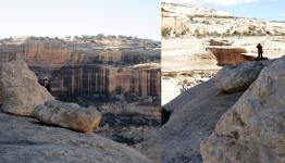
Looking back toward the stairs. Parking is up at the top of that hill. I added an arrow to indicate the trailhead informational signs.
--Click to Enlarge--
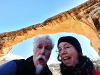
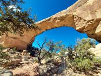
Second arch of the day
--Click to Enlarge--
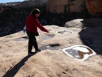
Karen points out something small swimming under the ice.
--Click to Enlarge--
Not a Trail, turn back. That dark edge is not a shadow; it's the edge.
--Click to Enlarge--
Another turnabout picture. That's as close as Karen came to the danger sign.
--Click to Enlarge--
Karen posing on the way back, under that looming overhang.
--Click to Enlarge--
Dramatic shot
--Click to Enlarge--
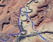
Map Through Day 10, the outward trip
--Click to Enlarge--
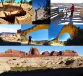
Evocative Pix from the day for social media posts.
--Click to Enlarge--
With one hand. I help Karen along. The other is on the shutter button. This is back to the other side of that arch.
--Click to Enlarge--
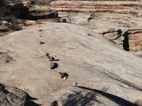
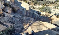
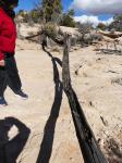
That's the trail, between those lines of rocks.
--Click to Enlarge--
Looking back at the arch, again.
--Click to Enlarge--
HooDoo! Hoodoo you think you're foolin'? ♫
--Click to Enlarge--
Heading down to Kachina Bridge, Dan discovers that he'd zipped his camera and water straps into his vest.Silly man.
--Click to Enlarge--
I don't know if this qualifies for the Death Stairs group on FaceBook.
--Click to Enlarge--
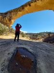
Karen poses as we prepare to descend to the Owachomo Bridge.
--Click to Enlarge--
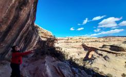
For such a hazy day, the light looks promising down there
--Click to Enlarge--
I pause and Karen gets ahead of me.
--Click to Enlarge--
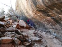
We contemplate how the park needs more support to maintain facilities. A handrail shouldn't bend to the ground.
--Click to Enlarge--
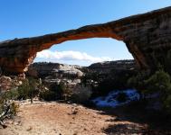
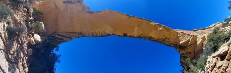
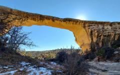
Getting closer to the Owachomo bridge.
--Click to Enlarge--
Obilgatory selfie with the Owachomo Bridge
--Click to Enlarge--
We clearly take ourselves seriously.
--Click to Enlarge--
I take a picture of the reflection in a puddle as Karen takes a picture of the bridge
--Click to Enlarge--
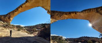
The picture Dan was taking is a panorama; left and right are each horizontal here.
--Click to Enlarge--
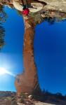
A vertical panorama. Karen is not actually hanging upside down.
--Click to Enlarge--
Some bridges are smaller than others
--Click to Enlarge--
Karen posing under the Owachomo bridge
--Click to Enlarge--
Karen often wonders what Dan is seeing. So, here is him and his sight.
--Click to Enlarge--
How many pictures do we need of Owachomo bridge?
--Click to Enlarge--
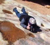
What does he see in there?
--Click to Enlarge--
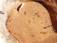
Something is burrowing in the sand in this pothole.
--Click to Enlarge--
Karen bids adios to the Owachomo bridge
--Click to Enlarge--
Following our best guess at the path back to the trailhead
--Click to Enlarge--
Back up top. Whew.
--Click to Enlarge--
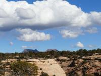
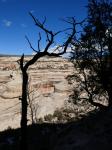
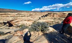
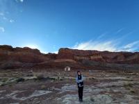
Peering at Bears Ears
--Click to Enlarge--
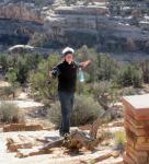
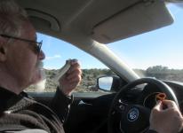
String cheese and pretzels for lunch.
--Click to Enlarge--
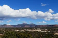
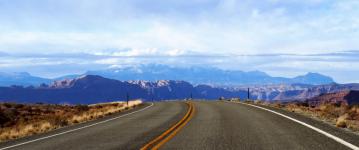
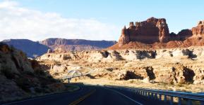
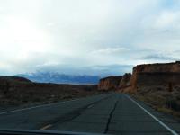
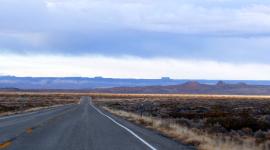
Scenic desert highways
--Click to Enlarge--
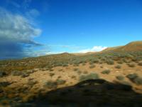
Roadside scenery
--Click to Enlarge--
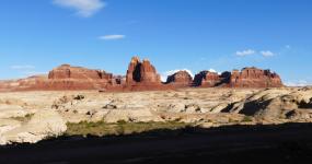
Many textures ahead
--Click to Enlarge--
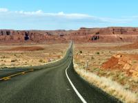
Another desert highway view
--Click to Enlarge--
Colorado river crossing ahead
--Click to Enlarge--
The Dirty Devil River valley
--Click to Enlarge--
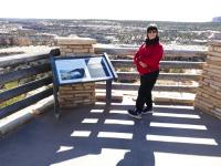
Stopped at a scenic rest area with access to the Dirty Devil River.
--Click to Enlarge--
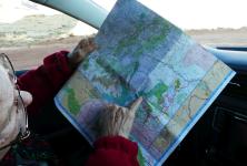
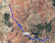
Figuring out where we are. The map is highlighted up to Natural Bridges.
--Click to Enlarge--
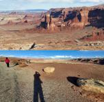
Just another scenic overlook, at two different focal lengths.
--Click to Enlarge--
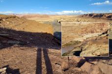
You can see the bridge on which we crossed the Colorado from here.
--Click to Enlarge--
Getting darker in the Glen Canyon National Recreation Area
--Click to Enlarge--
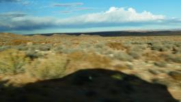
A break in the clouds casts our shadow across the desert
--Click to Enlarge--
Late afternoon casts our car shadow on the roadside.
--Click to Enlarge--
A lateral stripe of sunlight across the road ahead
--Click to Enlarge--
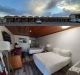
Whispering Sands Motel, Hanksville, Utah
--Click to Enlarge--
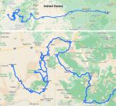
Nov 13, 2022 Route of the day
--Click to Enlarge--
One of the little jiggles in the apparently direct route. Good scenery.
--Click to Enlarge--