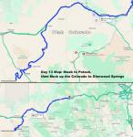
11/16/22: Lucky Day 13! Work Emergency for hours, then Slot Canyon scenery from Potash, UT to Glenwood Psgs, CO
As Day 13 began, we were up and partly packed to leave and break fast on the road, when I get a call from my job. Web site down! Their entire business runs off my site.
The day progressed from there. Pretty scenery, Slot Canyons, Following the Colorado River out of Utah into Colorado. Uphill all the way.
And I began a mission for rival Colorado Welcome Centers.
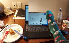
Day 13 Plan was to get up, pack, and get on the road to a coffee house for breakfast. We were up, and partly packed, when I get a call from my job. Web site down! Their entire business runs off my site. Usually, when the hosting company breaks the web site, I can get it fixed quickly. I am out in the desert. Had they called half an hour later, I might not have had signal. The time zone helps. Anyway, I spent 2 hours with tech support trying to figure out what the hosting company did to break our site. I had a clue, but not a fix. Karen brought me waffles and coffee from the lobby. The WB coffee mug was brought from home. My travel socks speak for themselves.
--Click to Enlarge--
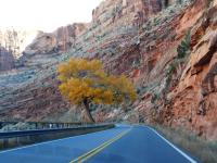
The web site is still not working at check-out time. The new IT guy back home is working on it. He said I could hit the road. Later, given everything I'd tried, he figured out what subtle thing had to be modified to accomodate what the hosting company had changed.Anyway, as foreshadowed last night, we head out to drive Scenic Byway State Route 279, the Potash Road.
--Click to Enlarge--
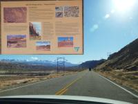
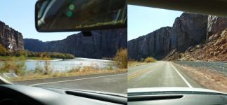
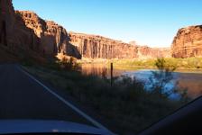
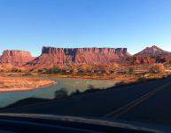
We stop at a pull out along SR 279 to see what there is to see. That's the Colorado River that this road follows.
--Click to Enlarge--
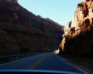
This drive is along a slot between cliffs, with the Colorado River to our South and the railroad tracks to our north.
--Click to Enlarge--
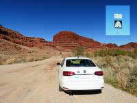
There were a few trailheads along this route, but we decided we were too worn out from narrows and goblins. The road pretty much ended at the potash boat ramp. With 4wd we could have gone up to Canyonlands (like that Jeep ahead of us), but we really needed to be heading back.
--Click to Enlarge--
SR 279 ends at the Potash Boat Ramp (and potassium extraction flats). Still a pretty place, if you like deserts. We do.
--Click to Enlarge--
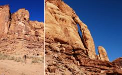
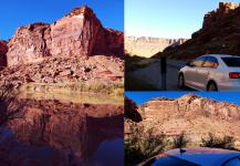
On the 25 mile drive back toward Moab and homeward, we stopped at a few places. Like Jug Handle Arch. We walked around a bit.
--Click to Enlarge--
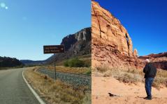
Karen took a picture of me taking this picture of Jug Handle Arch
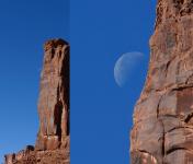
--Click to Enlarge--
The moon hugging the cliff. This is around back of Jug Handle Arch
--Click to Enlarge--
Karen drove so I could take pictures, now that we are not driving into the sun. Still on SR 279 along the Colorado River
--Click to Enlarge--
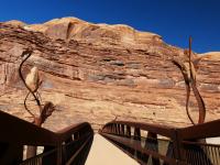
Once we got out of that little canyon, my phone pinged with the news that the hosting company had closed the ticket. But the site was still down! It's 12:30, and I spent some time talking the IT guy through some things to try in the parking lot. Then I joined Karen on this hiking trail. Pretty pedestrian bridge across the Colorado River.
--Click to Enlarge--
Well, we had to be moving on. so we drove back up the same scenic route we'd taken down so many days ago. But now the light was behind us. Karen pulled out a few times, and I took pictures.
--Click to Enlarge--
Stopped a few times to take pictures of rocks and reflections
--Click to Enlarge--
Sometimes the "light at the end of a..." didn't require a tunnel. Deep cuts by the Colorado River
--Click to Enlarge--
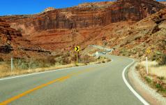
The road was narrow, but not straight. This route is old; carved by a river, followed by horses, then rails, then less than 100 years ago, a paved road.
--Click to Enlarge--
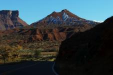
Snow ahead proves that we are climbing. Some snow on the shady side of the hill ahead. And you can see the snowy peaks peaking up at the right.
--Click to Enlarge--
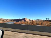
You can see some mild rapids on the Colorado river here. Our road continues to follow it upstream.
--Click to Enlarge--
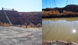
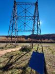
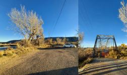
As we cross the Colorado River I notice an old and deckless suspension brige. We must go look.
--Click to Enlarge--
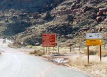
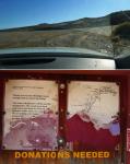
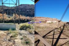
The road to the old bridge and the historical information board there are in dire need of maintenance.
--Click to Enlarge--
Karen preferred the view from the car when I took pictures like these.
--Click to Enlarge--
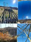
The sign says: RESTORED IN 2000The Dewey Bridge, constructed in 1916, is on theNational Register of Historic Places. In its prime it was designed to support the weight of 6 horses, 3 wagons and 9000 pounds of freight. It is significant for its outstanding Engineering Accomplishment and for its Historic role as a vital transportation andcommercial link connecting Southeastern Utah with Colorado and other points east. In the early decades of the twentieth century, Moab and other Southeastern Utah towns were dependent on communities in Western Colorado for everyday supplies, and markets for their agricultural products. This Bridge, which spans the formidable natural barrier of the Colorado River,was the first to provide a direct connection. Dewey Bridge is Utah's longest suspension bridge, and atthe time of its construction, was the second longest suspension bridge west of the Mississippi. It is also the State's longest clear span bridge.
--Click to Enlarge--
Another picture of us taking each other's picture.
--Click to Enlarge--
We took about 60 pictures in the half hour we spent admiring the bridge.
--Click to Enlarge--
But as 2ish approached, it was time to move on along Beehive 128
--Click to Enlarge--
As the interstate drew near, we parted ways with the narrowing Colorado RIver
--Click to Enlarge--
We're almost out of these older roads. Our goal is now getting homeward with some haste.
--Click to Enlarge--
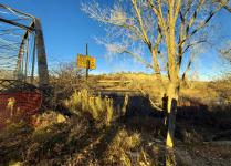
Just inside Colorado, we stopped to admire another decommissioned bridge across the Colorado.
--Click to Enlarge--
Shadow selfie of me with the bridge and the beyond "duh" bridge closed sign. There's steel rail and a concrete divider beyond the brush and orange fence.
--Click to Enlarge--
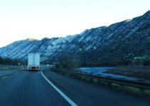
I-70 is still following the COlorado River as it narrows up into those snowy mountains
--Click to Enlarge--
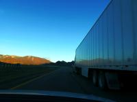
My last pic of a reflection off of a vehicle today. I promise. It's about to get dark, anyway.
--Click to Enlarge--
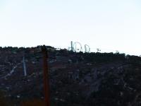
Looks like a ski lift and roller coaster up ahead.
--Click to Enlarge--
In case you wnder where the Best Western Caribou Lodge is found.
--Click to Enlarge--
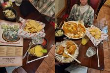
We had dinner at Tequila, a local restaurant across the street from the Best Western Antlers in Glenwood Springs. We shared a margrita and a single entree, and both got tipsy and stuffed. But we tip well for parsimonious diners.
--Click to Enlarge--
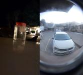
Another frigid night, so we put the cooler ice container atop the car to refreeze. This pic shows leaving it at night, and then through the peephole the next morning.
--Click to Enlarge--
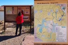
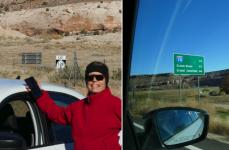
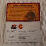
Mysterious Token of Appreciation from the Fruita Welcome Center. We stopped at the first Colorado welcome center, because Karen really had to stop. I wandered into the welcome center, and chatted with the attendants. They had been talking about how their counterparts at the far side of Colorado had sent them a hand delivered hand written message, and then wanted to one up them. So they hatched a plan to send something to them. A message, a token, something tangible. And I was conscripted. I had a Mission! Karen called me, wondering where I'd gone. I told her, "I have a Mission." She came to see while they were gathering cards and a token to send to the other side of the state. So here it is. I will be delivereing it to the far side center, tomorrow.
--Click to Enlarge--
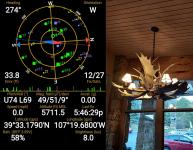
Day 16 Map, Moab to Potash and back up to Glenwood Springs
--Click to Enlarge--