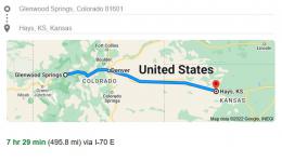
11/17/22: Day 14: Glenwood Springs to Hays, KS. A long day.
Mainly a day of driving home. From 11,000' down to 2,000' crossing from mid Colorado to mid-Kansas
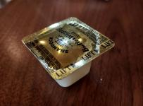
Glenwood Psrings, Colorado. In the bottom of this valley we are at 5,700' elevation. Freshness seals for the butter are bulging from the internal pressure. I'm so easy to amuse.
--Click to Enlarge--
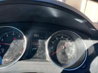
Hitting the road at 10am, after a couple of hours with IT, and finally getting the website (and business) back online. Yay? The sun shining on our dusty instrument panel shows we got 392 miles on 2/3 of a tank of gas. We'll probably need to get gas not much later this morning, as we climb up to the passes heading east. Prices seem high in the tourist town.
--Click to Enlarge--
Last night we couldn't see how green the White River (tributary of the Colorado) was.
--Click to Enlarge--
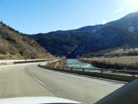
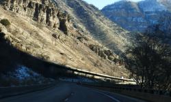
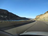
To put 4 lanes of highway in these narrow canyons, they need to stagger or stack the roadways.
--Click to Enlarge--
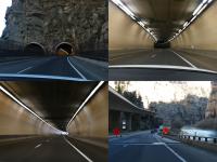
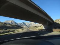
They unstack the roads to go through wiggle side-by-side tunnels, and then stack them again.
--Click to Enlarge--
Weird sky as we head up the Rockies in the morning
--Click to Enlarge--

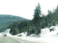
After passing Vail, we saw some snow. We expect more on the far side of the next pass.
--Click to Enlarge--
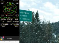
Stopped for a moment at Vail Pass. 10,603 feet, give or take.
--Click to Enlarge--
Stopped in the town of Frisco for gas. This is the valley between Vail pass and the Eisenhower tunnel. The two high points of I-70. They had a nice long-handled window washer, and the washer solution was only mostly frozen.
--Click to Enlarge--
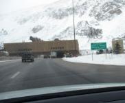
After Vail pass down around 10,600 feet, here is Eisenhower tunnel, the highest interstate point in the country at elevation of 11,158 feet. Sorry about the blur. I was driving, shooting blind, and the camera chose to focus on the snow on the windshield.
--Click to Enlarge--
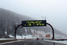
I'll be sure to do whatever the sign says.
--Click to Enlarge--
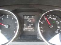
We've driven for an hour steadily over a mile a minute, and the car says we have another 750 miles to go on the tank. I've rarely touched the gas since the pass. I'd enjoyed watching the available distance climb as we ate up miles.
--Click to Enlarge--
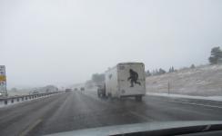
Sasquatch running to get out of the blowing snow
--Click to Enlarge--
By early afternoon we hit Aurora/Denver. Gateway to the flatlands in a rain/snow mix.
--Click to Enlarge--
Now for a few hours to finish Colorado and go deep into Kansas. Nothing to see here.
--Click to Enlarge--
After driving through snow in Denver, our car is coated in slushy salt
--Click to Enlarge--
Remember my mission from the western Colorado Welcome Center? Well, we had to drive into Kansas, take an exit, and head back into Colorado to deliver that token. So we entered Colorado yet again.
--Click to Enlarge--
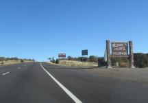
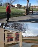
A shorter stop at this Welcome Center, requiring about a 20 minute detour to go east, west, and east again.
--Click to Enlarge--
Rivers are flowing the other way on this side of the Rockies.
--Click to Enlarge--
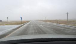
Western Kansas is not completely flat.
--Click to Enlarge--
Proof that we're heading east as the sun goes down.
--Click to Enlarge--
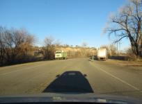
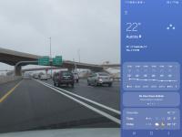
Arriving Hays, KS. Wind turbine fields (those bouncing lights) are a growing part of their income. 8pm CST. 10 hours of driving, plus a time change.
--Click to Enlarge--
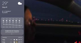
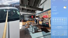
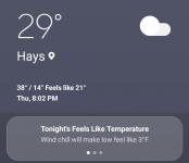
Hays, KS weather
--Click to Enlarge--
Day 14 Map: Glenwood Springs, CO to Hays, KS. Interstate all the way. Snow and sleet and sun and mountain passes.
--Click to Enlarge--