ElevationsBryceToLaughlin
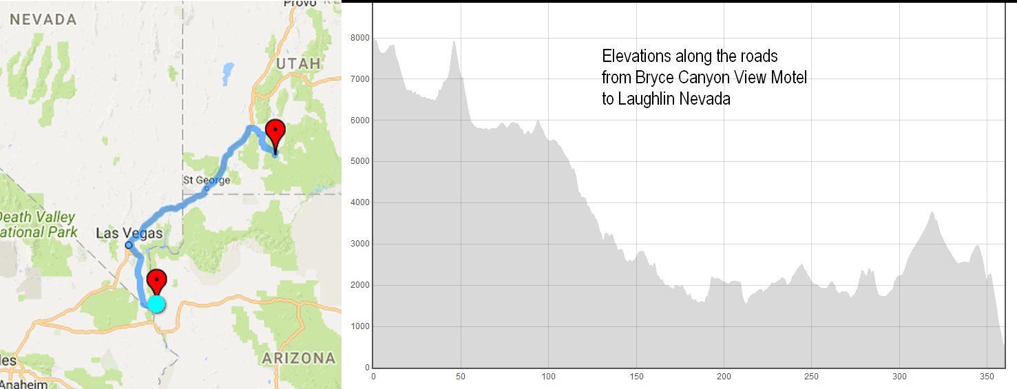
I found a site to illustrate the rise-and-falls of Friday's journey.https://www.doogal.co.uk/RouteElevation.phpThe trip nominally downhill from Bryce to Laughlin was hard on my sinuses. Mountain travelling during a rhinovirus is not so much fun.This chart leaves out the initial drop from Bryce Point at 9100 down to the motel at 8100. But I'd had overnight to adjust to that.
ElevationsBryceToLaughlin.jpg - 10/06/17 01:34pm
Back to 13 words and 48 thumbnails from "Day 7: A Bryce Canyon day, then down to Laughlin, NV"
Prev Pic
Previous Picture
Next Picture
Next Picture
Back to list of dates
See our other trips
You can use
keyboard arrow keys
for Previous ()
and Next ()
Copyright 1995 - 2024 by A Daniel Klarmann under a Creative Commons Attribution-Noncommercial-Share Alike 3.0 License (click for details).
In brief: Use for non-commercial purposes or other fair uses, as long as you give me credit.
Larger versions and commercial contract uses available on request.