Map10-13-2010
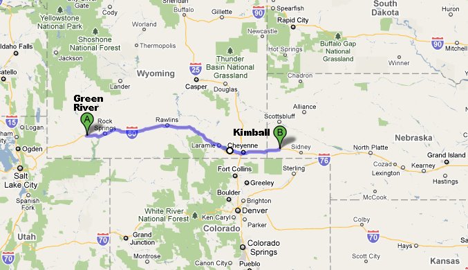
Here's yesterday's Progress. Note how Kimball Nebraska is just east of Denver, and about as high in the mountains. A topographical map would show how this is a relatively flat area of the Rockies. Well suited to wagon trails, along which a series of evolving roads have followed, culminating in the late 20th century I-80.
Map10-13-2010.jpg - 10/14/10
Back to 45 words and 52 thumbnails from "Day 21: Down from the Rockies and Across Nebraska"
Prev Pic
Previous Picture
Next Picture
Next Picture
Back to list of dates
See our other trips
You can use
keyboard arrow keys
for Previous ()
and Next ()
Copyright 1995 - 2024 by A Daniel Klarmann under a Creative Commons Attribution-Noncommercial-Share Alike 3.0 License (click for details).
In brief: Use for non-commercial purposes or other fair uses, as long as you give me credit.
Larger versions and commercial contract uses available on request.