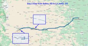
11/05/22: Day 2: From Salina,KS to La Junta, CO, mostly off the Interstate
Second day of flat country driving, across the time zone and into Colorado. Also Daylight Savings Fall-Back (two timezones with one border).
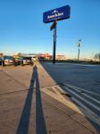
Good morning from the AmericInn in Salina, KS. Dan shadow selfie.
--Click to Enlarge--
Custom waffle irons at the breakfast area at AmericInn.
--Click to Enlarge--

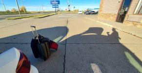
I roll out the suitcase train and take another shadow selfie before loading.
--Click to Enlarge--
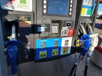
Confusing gas prices here in corn country. Three flavors of Regular gas and three color coded pump handles: No alcohol ($$$) 10% alcohol ($$) and "88" ($). Chose the lower price lower octane, as we are heading uphill.
--Click to Enlarge--
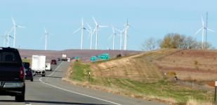
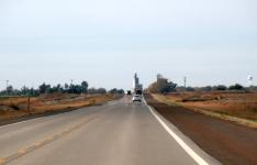
Windmills ahead at exit 232A telephoto shot across dark fields on a sunny day, and through a windshield at 75mph makes for some interesting ripples.
--Click to Enlarge--
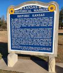
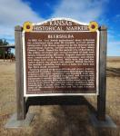
KANSAS HISTORICAL MARKERThe rolling land in this area was once sheep country, but now cattle roam here. These stone fence posts found are examples of the many still in use in this portion of Kansas. In an area where wood for posts was scarce, settlers used the materials at hand. The Greenhorn "post rock" was split from limestone strata, and with a little working, posts were created. Prior to American settlement, American Indians occupied this land for centuries. Although relations between over--land travelers, settlers, and the Indians were generally peaceful, tensions developed as traffic Increased and more permanent settlers arrived. This area witnessed a number of violent clashes during the 1860s as Indians took action to defend their lands and the U.S. government responded. Ellsworth. a former cattle town, is located approximately 7 miles south of here on K-14. Like other "Wild West" towns, Ellsworth experienced its share of lawlessness and violence. One incident In 1873 involved the shooting of several men, including the sheriff, and the taking over of Main Street. Ahead are Wilson (with the Wilson reservoir 5 miles to the north); Russell, an oil town; and Hays Erected by the State of Kansas
--Click to Enlarge--
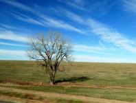
You have no idea how many pictures I have of things that seemed interesting at first glance. This stark tree going past at 70 is just one of them.
--Click to Enlarge--
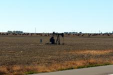
Kansas in November: Hay fields mown, and the fossil fuel mosquitoes busily sucking their nectar.
--Click to Enlarge--
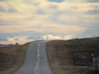
I've always appreciated the view of a long, straight road ending in a tall building. Reminds me of Oz.
--Click to Enlarge--
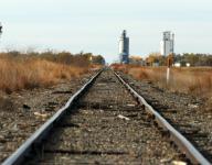
Old rail lines still in use say to me, Go West.
--Click to Enlarge--
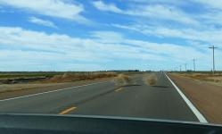
Got off the interstate to take KS-14 south and west. No rest areas along these roads. We pulled over to stretch and refill the water bottles.
--Click to Enlarge--
I take a car window selfie as Karen organizes lunch
--Click to Enlarge--
We are on our "Just get to Colorado" phase of our trip. Not sightseeing yet. So we zoom past things like Fort Larned National Historic Site
--Click to Enlarge--

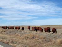
Cows along KS-156
--Click to Enlarge--
Kansas Historical Marker: In 1882 the first Jewish agricultural colony in Kansas was established when some 60 recently arrived Jewish immigrants from Russia, sponsored by the Hebrew Union Agricultural Society, settled northeast of here along Pawnee Creek.Named for the ancient city of Beersheba, the colony stretched over several sections of land, each family homesteading 160 acres. Dugouts and sod houses were constructed for homes, a synagogue, and school. Cow chips were used for fuel. Wells were dug and the native prairie was plowed and planted. Within the first few months, a wedding took place, a baby was born, and the first death occurred. Farming proved to be unprofitable and severe winters produced hardships. To supplement their meager incomes, colonists sold their equipment and livestock, took jobs with the railroad, mortgaged their land, and established businesses in nearby Ravanna and Eminence As the two towns died out in the 1890s after a bitter county seat battle lost by both towns, the colonists sold or abandoned their homesteads. A decade after the colony was established, none of the colonists remained and the land reverted to prairie. Erected by Kansas Historical Society and Kansas Department of Transportation.
--Click to Enlarge--
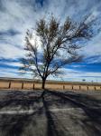
Nice tree at the Beersheba rest stop and KS-156
--Click to Enlarge--
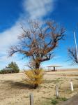
Tree and sky. I am easy to amuse. Beershba historical marker stop.
--Click to Enlarge--
Entering Mountain time, so we Fall Back about 12 hours before all the normal Daylight Time folks this Fall Back Eve. But then we get to do it again tonight.
--Click to Enlarge--
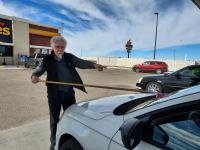
At every stop, I clean the windshield. Mostly because of bugs. This Loves at a highway intersection had a nice long handled cleaner.
--Click to Enlarge--
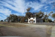
A lot to unpack here. This was once a busy welcome center and probably a gas stop at the Kansas-Colorado border. But interstates killed off most of the parallel state and federal highway businesses. So this ruin is what is left of the heyday of auto touring in mid-century America.Note the Welcome to Colorado sign on the left. And the stone marker next to the green sign just this side of it.
--Click to Enlarge--
Video still of a family of tumbleweeds that rolled across the road right in front of us. There were no survivors.
--Click to Enlarge--
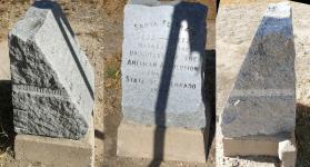
Stone marker on the Kansas-Colorado border on KS-152 Santa Fe Trail 1822-1872Marked by the Daughters of the American Revolution and the State of Colorado 1908
--Click to Enlarge--
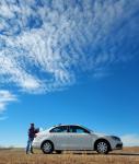
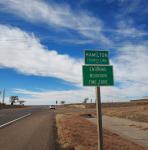
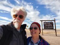
And then we enter the sere, dry country of Colorful Colorado. Another selfie at a welcome sign.
--Click to Enlarge--
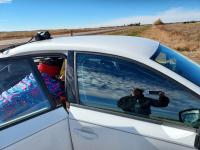
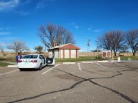
We had parked on the Kansas side of the border for a while. Then we drove across and found a barely marked, well hidden, rest area! The Holly Rest Area, a badly faded sign proclaimed.
--Click to Enlarge--
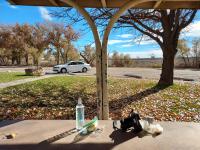
So we had a light lunch, down out of the wind.
--Click to Enlarge--
Good thing there is a curve sign.
--Click to Enlarge--
I was driving and Karen navigating when we got to the city of La Junta. This is usually a bad combination. I had set my navigator to La Junta, and then I thought I had changed it to the Econolodge in La Junta. So Karen was reading the digital map, who was also giving me directions. Have you ever tried to go to A Town? The navigator tried to get me into the center of town. The center. I went around a block twice before I figured out that we didn't have a proper destination. So I pulled over and took my phone, and re-set it to the motel. But its directions, in this town with new and old roads at various angles sent us into a rail yard. I stopped and checked the map again. This time, I put it in my visual memory. After that, it was easy. But, as we have not driven much at all since the pandemic began, this second 400 mile day in a row was exhausting.
--Click to Enlarge--
While on the road, I try not to publish on FaceBook that we are away. Why tip off lurking burglars? So I posted this as my new profile picture as Margarita Selfie, without saying that we were out of town.
--Click to Enlarge--

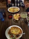
Our first sit down dinner on the road, at Felisa's next to the Econolodge in La Junta, CO. My smothered chimichanga was huge.
--Click to Enlarge--
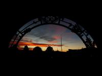
Had a nice sunset as we left Felisa's and walked across the parking lot to the Econolodge.
--Click to Enlarge--
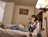
Some of these old motels still have room phones, and some of those still have message lights and modem jacks. Note the wall hanging print of a map of the U.S. made of license plates from each state.
--Click to Enlarge--
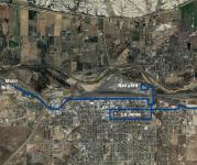
Day 2 map from Salina, KS to La Junta, CO. Mostly off the interstate, on the old highways.Insets detail the time we spent at the border, where GPS lost track of us down in the hidden rest area, and our unintentional tour of La Junta.
--Click to Enlarge--