11/06/22: Day 3: La Junta to Salida, Co. Down 10 and up 69, into the mountains.
Another day told in pictures. In brief: South and west from La Junta, and into the mountains, and a slide up 69 along Wet Mountain Valley to Salida.
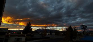
View through our La Junta Econolodge room window at 6:20 and 7:20 in the morning; before and after the "continental" breakfast.
--Click to Enlarge--
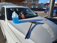
Before starting out on Day 3, from the EconoLodge, I clean yesterday's bugs from the windshield.
--Click to Enlarge--
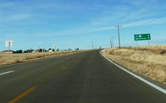
Leaving La Junta, our next waypoint on the road sign: Walsenburg.
--Click to Enlarge--
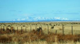
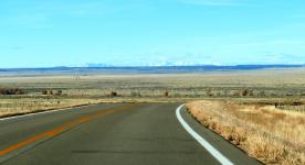
Seeing a bit of color in Colorful Colorado. But, wait! Are those mountains on the horizon?
--Click to Enlarge--
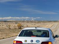
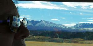
Zooming in through the wobbly windshield (~400mm 35mm equiv) those do appear to be mountains! Karen is driving.
--Click to Enlarge--
Definitely driving toward the mountains.
--Click to Enlarge--
We disturbed a local diner at mile 58 on CO-10. Sorry for the blur; a quick snapshot with a (virtual) long lens through the windshield of a car going about 16% over a mile a minute.
--Click to Enlarge--
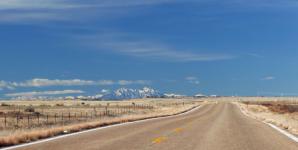
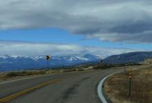
Mountains becoming more obvious, now only 120mm equiv lens. Notice the road heading toward the mountains to the left? That's not our road.
--Click to Enlarge--
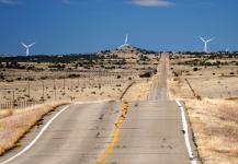
How many pictures do I need of distant mountains? Apparently about 20x as many as I share. But, wait. (Spoiler:) Is that a wind turbine over on the right, behind the power lines?
--Click to Enlarge--
On this travel day, we don't have shoulders. We also rarely see other cars. So when I wanted to stop and take a picture without road vibration or window blur, Karen just stops in the middle of the highway. We could hear another car from miles away, if one appeared.
--Click to Enlarge--
Ah, look. Another car is coming. It should pass us in only five minutes or so.Time to get back in the car.
--Click to Enlarge--
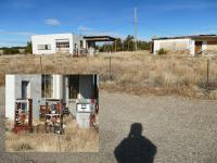
We pulled over at the gas station and cafe at the Las Animas county line. From the look of the pumps, I'd guess the business failed around the 1970's gas crisis.
--Click to Enlarge--
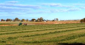
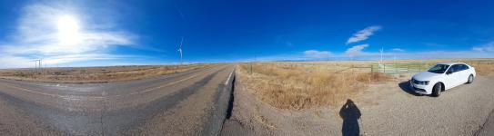
A paorama of Colorful Colorado at a farm gate pull-out.
--Click to Enlarge--
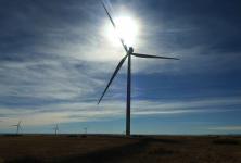
Frame from a video in the occasional shadow of a wind turbine. Note the shadow coming toward me, from the blade crossing the sun. For scale, see the flight of stairs at the bottom of the column.
--Click to Enlarge--
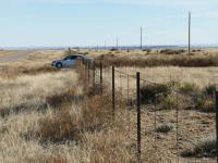
I wanted to spend some time with the windmills, so Karen pulled off at a farm access gate. I waded through the brush and stood in the chill wind for a while, mostly taking video.
--Click to Enlarge--
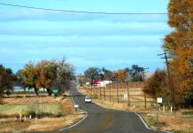
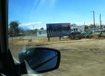
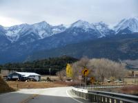
Welcome to Wahlsenburg, CO. From here you can see the mountains without a telephoto lens (on the left)
--Click to Enlarge--
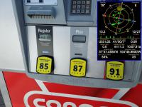
We're at high elevation; regular gas is down to 85 octane, and $3.319/gallon
--Click to Enlarge--
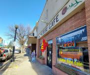
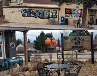
We stopped for brunch in Wahlsenburg at the Alpine Rose Cafe. The Bud Light and the Hunters Welcome signs let us know this is not an espresso cafe, but a mile-high-pie sort of place.
--Click to Enlarge--
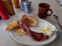
Brunch at the Alpine Rose Cafe was served by the 12 year old son of the owner. We landed here between the early hunters, and the church crowd.
--Click to Enlarge--
We headed north and west from Wahlsenburg on CO-69, heading up the Wet Mountain Valley.
--Click to Enlarge--
Our first sighting of red rock, as the band between the bright white layers in the hills on the right
--Click to Enlarge--
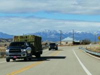
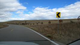
There were many trucks on the lower part of CO-69. But what the hay, they thinned out as we headed uphill.
--Click to Enlarge--
We zoomed past ghost towns. Even apparently holy ghost towns.
--Click to Enlarge--
Karen did most of the driving, because I wanted to take pictures. It makes her nervous when I drive on winding mountain roads when I take pictures. We both got polarized prescription bifocal driving glasses for this trip.
--Click to Enlarge--
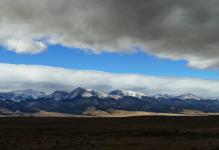
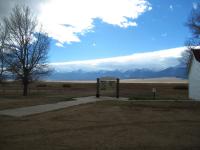
It was a day of interesting clouds up in these mountains.
--Click to Enlarge--
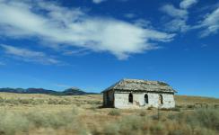
It looks like many a wagon didn't make it through this place.
--Click to Enlarge--
We stopped so I could just look around, feel the wind, hear the grasses blow.
--Click to Enlarge--
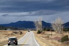
As threatening as the skies appeared, we had little weather to worry about.
--Click to Enlarge--
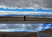
Karen took a picture of Dan taking a panorama with his phone, on her phone
--Click to Enlarge--
There's a little airport up here on CO-69 at 1.6 miles high. You'd have to dig down a few thousand feet to join the mile high club.
--Click to Enlarge--
We stopped where CO-69 met its inverse CO-96 in Westcliffe, Colorado for a pick me up at the Tumbleweed Coffee House. Yes, Google Maps helps us find non-Starbuck's local caffeineries.
--Click to Enlarge--
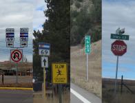
Okay, 69 or 96. We can't turn back!Some interesting road number markers.Of note:The government got tired of replacing mile marker 69's a long time ago; they disappear into dorm rooms and the like way too quickly. Now the mile between 68 and 70 is always marked as 68.9. Even on route 69!
--Click to Enlarge--
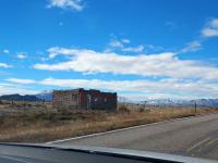
We pulled out to see the Beckwith Ranch historical Marker. Clearly someone energetic started this, but it never quite got done.
--Click to Enlarge--
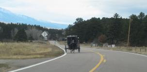
We did slow to 60 for this curve. The horse was going all out.
--Click to Enlarge--
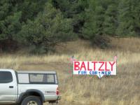
Election signs in other counties often seem humorous. This trip spans a midterm election, for which we had voted early.
--Click to Enlarge--
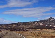
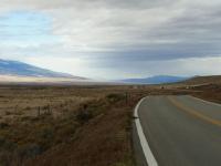
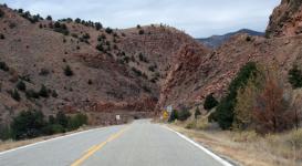
The geology is getting more interesting. 35mph is a good sign for scenery (on dry roads).
--Click to Enlarge--
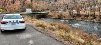
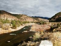
We'd been driving upstream along this river a while. Finally stopped to stretch our legs in Cotopaxi.
--Click to Enlarge--
Autumn is fading here in November. But there are still some colorful trees. Just a few.
--Click to Enlarge--
One thing I like about interesting skies, i.e "Partly Cloudy" is how bare trees can be either glowing foreground or sillouettes, depending on timing. Angels or demons?
--Click to Enlarge--
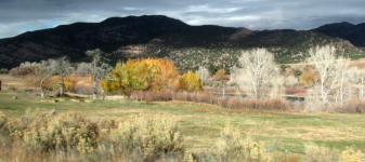
Brooding mountains and gay foliage
--Click to Enlarge--
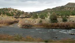
Architecture is a mnor obsession of mine. I like old bridges, like this railroad creek-hopper.
--Click to Enlarge--
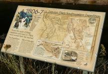
We pulled over to read a historical marker, and I spent more time on the scenery.
--Click to Enlarge--
Zebulon Pike's Southwestern Expedition 1806-07
--Click to Enlarge--
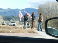
These insecure fellas stood outside the Welcome Center of Salida, CO. This town is a New Agey, Crystal healing, get-your-zen-on stronghold. I don't know how these characters with their rapid fire codpieces fit in.
--Click to Enlarge--
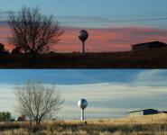
At the Salida Inn and Monarch Suites we had electric sunset views out both sides of the room. Ending a day of dramatic skies.
--Click to Enlarge--