11/07/22: Day 4: From Salida to Durango
A day of driving over a mountain range, climbing over a snow bank, and a sunset walk along the tracks of the Silverton Train, from the C.W. McCall song (YouTube opens in new tab).
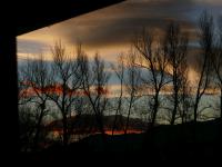
Dawning Day 4: Sunrise view from our room in Salida, CO
--Click to Enlarge--
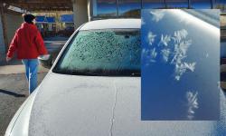
Karen moved our icy car into the sun to thaw while we had breakfast in Salida
--Click to Enlarge--
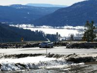
Heading south on U.S-285 into the low morning sun, one can see the perpetual sand plume that created Great Sand Dune National Park. We are heading toward there, but will veer off before we get there. See our 2017 trip for pix and video of that park.
--Click to Enlarge--
Leaving one layer of mountains behind us.
--Click to Enlarge--
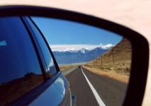
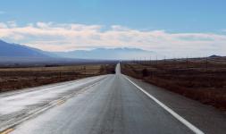
South on US-285 from Salida
--Click to Enlarge--
The road arrow sign says "Merge." The rocks say, "We mean it."
--Click to Enlarge--
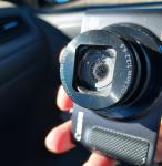
Okay. I think I've finally learned my lesson: Never bring cameras that aren't up to snuff. This one still works fine. But about 10 years ago, Canon chose to save a few pennies by leaving out the felt filter gaskets in between lens barrels. So their cameras now suck in dust. This one has already been on a road trip with us. Even on this particular road. There is no way to remove the dust from between the lenses. Well, it can be done, if you have special tools to re-align the lenses, only available at the factory. It costs more to clean than to replace. The dust is only a problem when shooting toward the light. About half of the time.
--Click to Enlarge--
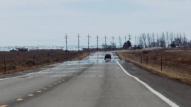
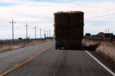
One sign of agriculture is many slower vehicles, shedding produce. We drove intot he haystorm and passed. I took a video!
--Click to Enlarge--
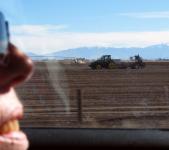
Plenty of signs of agriculture up here in the mountain valleys.
--Click to Enlarge--
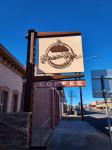
Many local businesses with comforting names, like "Gunbarrel Station."
--Click to Enlarge--
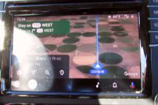
We don't understand why or when the App Connect chooses to show the satellite view; what we last used on the phone does not seem to affect that. But it was interesting to see what these alternating brown and green (winter wheat?) fields look like from above.
--Click to Enlarge--
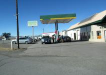
We left US-285 to go west on CO-112 and stopped in Del Norte for a latte and patstries at a Menonite micro-bakery named Raisin' Rye. Rye is the name of the owner's youngest daughter.
--Click to Enlarge--
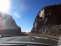
As we zoomed on west on US-160, we got higher. Snow got more apparent.
--Click to Enlarge--
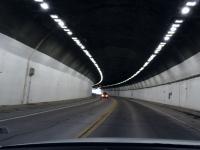
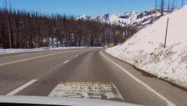
When you are in a tunnel, they don't need to warn you about "Curve Ahead."
--Click to Enlarge--
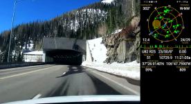
I was feeling it in my ears, so I popped open the handy GPS Status app and saw that we are getting high.
--Click to Enlarge--
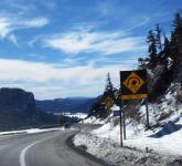
Wolf Creek Summit Pass Elevation 10,856
--Click to Enlarge--
Hairpin curve: A sign of things to come. It was chilly out there on Wolf Creek Pass. Karen waited in the car.
--Click to Enlarge--
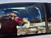
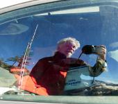
Car window selfie at Wolf Creek Pass.
--Click to Enlarge--
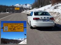
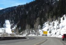
Up in the mountain passes, some signs get knocked off of poles. And others get scraped by snow plws. This warning, that trucks over 13 tons have to keep it under 25, is also a warning to us zoomers, who need to be ready for slow pokes.
--Click to Enlarge--
The first of several runaway truck ramps coming up. In "1250 feet" aka a shy quarter mile.
--Click to Enlarge--
The second runaway ramp has seen some recent use
--Click to Enlarge--
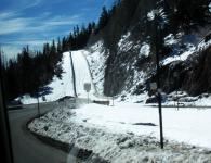
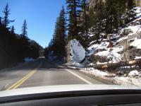
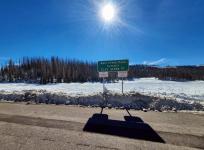
The hairpin turn is in sight! But, there appears to be a berm of snowblocking the scenic overlook access drive!
--Click to Enlarge--
Karen pulled over into the shoulder left between the hairpin turn and the snowbank blocking the scenic overlook. I walked up through the slush to take a snapshot overlooking the scenic overlook.
--Click to Enlarge--
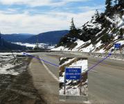
Looking down on the scenic overlook. See the brown sign to the right of the car? That's the information sign for what we would be seeing.
--Click to Enlarge--
I climbed over the snow bank and took a panorama. Karen took a picture of me taking the panorama, so I took one of her taking a picture of me. Turnabout shots.
--Click to Enlarge--
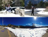
Window selfie while I stood on the snowbank. The gate to block the road is behind me.
--Click to Enlarge--
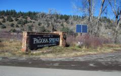
We zipped through Pagosa Springs as quickly as lunch hour allowed. We had done the springs in our 2006 trip.
--Click to Enlarge--
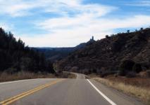
We appear to be haeding toward penis rock. Actually, "Chimney Rock" is the official park name. We're not stopping there on this trip. We did in 2017.
--Click to Enlarge--
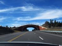
A wildlife overpass! We'd seen a couple in Canada on other trips. But this is our first in the U.S.
--Click to Enlarge--
By 2:00, we were already pretty tired. Not used to the altitude, and also some short nights. So we stopped early, in historic Durango.
--Click to Enlarge--
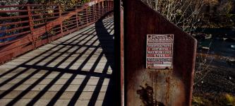
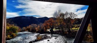
Bridges and shadows, and babbling streams. The sign reads: Steadfast Bridges, Pedestrian Traffic, Light Vehicle, Max load 5 tons. Biltolast Products Inc, Fort Payne, Alabama, March 2001, Serial number 1308
--Click to Enlarge--
View from the bridge, our car visible tucked under the redder tree.
--Click to Enlarge--
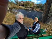
Lacking a selfie stick, my arm just has to do. Welcome to Durango.
--Click to Enlarge--
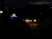
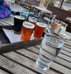
We checked in to the Days Inn Durango, rested a bit. We are out of shape, and needed to get a bit of rest. Then went next door to High Trestle micro brewery (or Durango Beer and Ice), and had a flight of 4 nice beers and I had a good burger and fries, and Karen the green chile with pork. This is a lot of beer for us.
--Click to Enlarge--
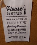
Sign of the times: Please do not flush Paper Towels, Tissues and Wipes, Sanitary Products, Kittens and Puppies, Hopes and Dreams. Thank You.
--Click to Enlarge--
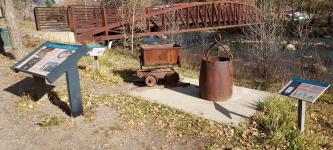
As sunset approached, and our systems flush with many little local beers, we wandered down the hill to the river and tracks. Yes, this is the famous Silverton Line. But we got here during the two weeks of the year the steam engines are down for maintenance
--Click to Enlarge--
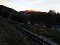
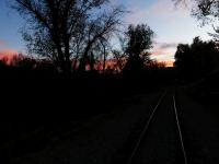
We walked a ways down the tracks as the sun dropped behind the mountains.
--Click to Enlarge--
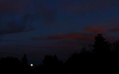
Full moon is arising
--Click to Enlarge--
We reached a road crossing, and then followed the road up from the river back to main street, and along that back to the hotel.
--Click to Enlarge--